Other ID: IB A-12-00-GK
Status: Completed
Organization(s): USGS, Woods Hole Coastal and Marine Science Center
Funding Program(s):
Principal Investigator(s): Page Valentine
Affiliate Investigator(s): NOAA/NMFS: Frank Almeida
Information Specialist(s): Page Valentine
Data Type(s): Biological Field Study: Experiments (biological), Biological Field Study: Surveys (biological), Imagery: Photo, Imagery: Video, Location-Elevation: Navigation, Sampling: Biology, Sampling: Geology, Visual Identification: Species ID, Sonar: Sidescan
Scientific Purpose/Goals: Biological and geological obs.; video/photo/grab sampling; trawling and sampling for invertebrates; habitat studies in Closed Area II, eastern Georges Bank.
Vehicle(s):
Start Port/Location: Woods Hole, MA
End Port/Location: Woods Hole, MA
Start Date: 2000-06-19
End Date: 2000-06-29
Equipment Used: SeaBOSS, Edgetech Sidescan sonar, P-code GPS, Van Veen grab sampler, Digital camera
Information to be Derived:
Summary of Activity and Data Gathered: 169 stations; 145 sediment/invertebrate bio samples, 169 video tracks, 157 photo tracks.
Staff: Robert Barton, Dann Blackwood, Barry Irwin, Joseph S. Newell, Kenneth F. Parolski, Page Valentine, Charles Worley
Affiliate Staff:
NOAA: Frank Almeida
Jason Link and others
Notes: NOTE: Mob on Wed. and Thurs. June 14, 15; demob Thurs. June 29. Original Center People field contained: At sea: Page Valentine, Dann Blackwood, and Chuck Worley; Mob/demob: Joe Newell, Ken Parolski, Barry Irwin, Barton.
Project = Georges Bank Habitats, Georges Bank Habitats
Information from Foghorn: SEABOSS w/winch, P-code with BarryNav, extra Van Veen grab for NMFS use; EdgeTech sidescan sonar, \"Italian\" winch, TDU plotter;
Location:
Georges Bank, United States, North America, North Atlantic,
| Boundaries | |||
|---|---|---|---|
| North: 41.488 | South: 40.378 | West: -69.665 | East: -66.547 |
Platform(s):
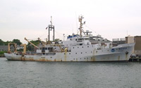 Albatross IV |
| Survey Equipment | Survey Info | Data Type(s) | Data Collected |
|---|---|---|---|
| SeaBOSS | --- | Surveys (biological) Experiments (biological) Species ID Photo Video Geology Biology | 2000-012-FA-SC-001 (GRAB samples) 2000-012-FA-PH-001 (CD ROM disk of BOTTOMPHOTO GEORGES ) |
| Edgetech Sidescan sonar | --- | Sidescan | |
| P-code GPS | --- | Navigation | |
| Van Veen grab sampler | --- | Geology | |
| Digital camera | --- | Photo | 2000-012-FA-PH-002 (Deck photos of field activity operations) |
