Other ID: IB C-29-00-PR
Status: Completed
Organization(s): USGS, Woods Hole Coastal and Marine Science Center
Funding Program(s):
Principal Investigator(s): Uri Ten Brink
Affiliate Investigator(s): Christa von Hillebrandt, Univ. of Puerto Rico and the P.R. Seismic network
Information Specialist(s): Erich Roth
Data Type(s): Location-Elevation: Navigation, Seismics: Ocean Bottom Seismometer
Scientific Purpose/Goals: Retrieve ocean bottom seismometers deployed during cruise 00028.
Vehicle(s):
Start Port/Location: Mayaguez, Puerto Rico
End Port/Location: Mayaguez, Puerto Rico
Start Date: 2000-06-13
End Date: 2000-06-15
Equipment Used: GPS (wh), Ocean Bottom Seismometer
Information to be Derived:
Summary of Activity and Data Gathered:
Staff: Jefferey Nealon, Erich Roth, Uri Ten Brink
Affiliate Staff:
Russell Sell; Rafael Abreu
Red Sismica (Puerto Rico Seismic network)
UPRM; Sr. Ramon Alonso
Dept. de Recursos Naturales; Kurt Grove
Sea Grant Program; Robert Iuliucci
Contractor; David Martinez
Dept. of Geology
UPRM; Samuel Vega Figueroa
Red Sismica
UPRM
Notes: Original Center People field contained: Greg Miller, Erich Roth, Uri ten Brink, Jeffrey Nealon, Russell Sell.
Project = Caribbean Tsunami and Earthquake Study, Caribbean Tsunami and Earthquake Study
Location:
western Puerto Rico, United States, North America, North Atlantic;
| Boundaries | |||
|---|---|---|---|
| North: 19 | South: 17.5 | West: -67.7 | East: -67 |
Platform(s):
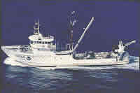 Chapman |
Martin, J.L., ten Brink, U.S., von Hillebrandt, C., Roth, E.G., and Miller, G., 2001, Project PROBES (Puerto Rico Ocean Bottom Earthquake Survey): U.S. Geological Survey Open-File Report 01-112, 89 p., URL: https://doi.org/10.3133/ofr01112.
| Survey Equipment | Survey Info | Data Type(s) | Data Collected |
|---|---|---|---|
| GPS (wh) | --- | Navigation | |
| Ocean Bottom Seismometer | --- | Ocean Bottom Seismometer |
