Other ID: MH33B-00; IB H-61-00-BH
Status: Completed
Organization(s): USGS, Woods Hole Coastal and Marine Science Center
Funding Program(s):
Principal Investigator(s): Michael Bothner
Affiliate Investigator(s):
Information Specialist(s): Michael Casso
Data Type(s): Biological Field Study: Experiments (biological), Imagery: Photo, Imagery: Video, Location-Elevation: Navigation, Sampling: Geology
Scientific Purpose/Goals: The cruise objective is to collect sediment cores at 6 long-term monitoring stations within Boston Harbor. The cores will be used to determine the concentrations and inventories of heavy metals. The previous work at these stations has documented a 50% decrease in metal concentrations in surface sediments between 1977 and 1993. This sampling will check conditions just before the sewage outfall is changed from Deer Island (at the mouth of the harbor) to the new location 9 miles offshore.
Vehicle(s):
Start Port/Location: U.S. Coast Guard Base, Boston, MA
End Port/Location: U.S. Coast Guard Base, Boston, MA
Start Date: 2000-07-09
End Date: 2000-07-09
Equipment Used: DGPS, Piston corer, Slow corer, Van Veen grab sampler, Osprey camera system, Digital camera
Information to be Derived:
Summary of Activity and Data Gathered:
Staff: Robert Barton, Dann Blackwood, Michael Bothner, Michael Casso, Joseph S. Newell, Richard Rendigs
Affiliate Staff:
J. Blackwood - USGS Volunteer; M. Santos - USGS; From WHOI: Rachel Cave
Anna Euser
Notes: Original Center People field contained: Field work - From USGS: Mike Bothner, D. Blackwood, J. Blackwood (volunteer), M. Casso, R. Rendigs, M. Santos; Mobilization: B. Barton, J. Newell.
Project = The Massachusetts Bay Experiment, The Massachusetts Bay Experiment
Location:
Boston Harbor, Massachusetts, United States, North America, North Atlantic,
| Boundaries | |||
|---|---|---|---|
| North: 42.4 | South: 42.23 | West: -71.08 | East: -70.87 |
Platform(s):
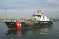 Marcus Hanna |
Bothner, M.H., and Butman, Bradford (eds.), 2007, Processes influencing the transport and fate of contaminated sediments in the coastal ocean—Boston Harbor and Massachusetts Bay: U.S. Geological Survey Circular 1302, 89 p., https://doi.org/10.3133/cir1302.
Butman, B., Bothner, M.H., Alexander, P.S., Lightsom, F.L., Martini, M.A., Gutierrez, B.T., and Strahle, W.S., 2004, Long-term oceanographic observations in western Massachusetts Bay offshore of Boston, Massachusetts; data report for 1989-2002: U.S. Geological Survey Digital Data Series DDS-74, Version 2.0, DVD-ROM, URL: https://doi.org/10.3133/ds74_v2.
Butman, B., Dalyander, P.S., Bothner, M.H., Borden, J., Casso, M.A., Gutierrez, B.T., Hastings, M.E., Lightsom, F.L., Martini, M.A., Montgomery, E.T., Rendigs, R.R., and Strahle, W.S., 2009, Long-term oceanographic observations in Massachusetts Bay, 1989 - 2006 (version 3): U.S. Geological Survey Data Series 74, https://doi.org/10.3133/ds74.
| Survey Equipment | Survey Info | Data Type(s) | Data Collected |
|---|---|---|---|
| DGPS | --- | Navigation | |
| Piston corer | --- | Geology | |
| Slow corer | --- | Geology | 2000-061-FA-SC-001 (CORE samples) |
| Van Veen grab sampler | --- | Geology | |
| Osprey camera system | --- | Photo Video | |
| Digital camera | --- | Photo | 2000-061-FA-PH-001 (Deck photos of field activity operations) |
