Other ID: IB D-63-00-GK
Status: Completed
Organization(s): USGS, Woods Hole Coastal and Marine Science Center
Funding Program(s):
Principal Investigator(s): Page Valentine
Affiliate Investigator(s): Frank Almeida, NMFS, Woods Hole; Jeremy Collie, URI
Information Specialist(s): Page Valentine
Data Type(s): Biological Field Study: Experiments (biological), Biological Field Study: Surveys (biological), Imagery: Photo, Imagery: Video, Location-Elevation: Navigation, Sampling: Geology, Visual Identification: Species ID
Scientific Purpose/Goals: Benthic habitat studies in closed areas on Georges Bank and in Great South Channel.
Vehicle(s):
Start Port/Location: Woods Hole, MA
End Port/Location: Woods Hole, MA
Start Date: 2000-10-30
End Date: 2000-11-09
Equipment Used: P-code GPS, SeaBOSS, Camera- deep sea, Digital camera, Dredge
Information to be Derived:
Summary of Activity and Data Gathered: 19 stations; 10 sediment/invert bio, 3 dredges, 16 video/photo.
Staff: Dann Blackwood, Sarah Fuller, Barry Irwin, Tammie Middleton, Joseph S. Newell, Kenneth F. Parolski, Page Valentine, Charles Worley
Affiliate Staff:
NMFS: Frank Almeida
Jason Link
Robert Reid
Vince Guida; URI: Jeremy Collie
Jay Hermsen
2 students
Notes: Mobe on Thurs/Fri, Oct. 26-27; depart on Mon, Oct. 30. Demobe on Friday AM Nov. 9. Original Center People field contained: Page Valentine, Dann Blackwood, Sarah Fuller, Tammie Middleton, and Chuck Worley; Mobe: Joe Newell, Ken Parolski, Barry Irwin.
Project = Georges Bank Habitats, Georges Bank Habitats
Information from Foghorn: P-code navigation system w/bridge monitor, SEABOSS with winch, EdgeTech sidescan w/winch; samplers provided by NMFS
Location:
Georges Bank, United States, North America, North Atlantic,
| Boundaries | |||
|---|---|---|---|
| North: 42.079 | South: 40.733 | West: -69.293 | East: -67.249 |
Platform(s):
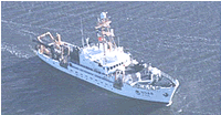 Delaware II |
| Survey Equipment | Survey Info | Data Type(s) | Data Collected |
|---|---|---|---|
| P-code GPS | --- | Navigation | |
| SeaBOSS | --- | Surveys (biological) Experiments (biological) Species ID Photo Video Geology Biology | 2000-063-FA-SC-001 (GRAB samples) |
| Camera- deep sea | --- | Photo | |
| Digital camera | --- | Photo | 2000-063-FA-PH-002 (Deck photos of field activity operations) |
| Dredge | --- | Biology Geology |
