Other ID: NMFS cruise DL0106; IB D-15-01-GK
Status: Completed
Organization(s): USGS, Woods Hole Coastal and Marine Science Center
Funding Program(s):
Principal Investigator(s): Page Valentine
Affiliate Investigator(s): Robert Reid, NMFS
Information Specialist(s): Page Valentine
Data Type(s): Biological Field Study: Experiments (biological), Biological Field Study: Surveys (biological), Environmental Data: CTD, Imagery: Photo, Imagery: Video, Sampling: Biology, Sampling: Geology, Sonar: Sidescan, Visual Identification: Species ID, Location-Elevation: Navigation
Scientific Purpose/Goals: USGS/NMFS benthic habitats studies: collect sediment samples, video/photo, otter trawl samples, and sidescan sonar imagery.
Vehicle(s):
Start Port/Location: Woods Hole, MA
End Port/Location: Woods Hole, MA
Start Date: 2001-06-11
End Date: 2001-06-22
Equipment Used: Trawl, Dredge, CTD 19+ with OBS, PAR, DO, Chl, SeaBOSS, Digital camera, Edgetech DF-1000 sidescan sonar, P-code GPS
Information to be Derived:
Summary of Activity and Data Gathered:
Staff: Dann Blackwood, Page Valentine, Charles Worley
Affiliate Staff:
NMFS: Bob Reid
Vince Guida
Dave Packer; Canadian Geological Survey: Brian Todd
Notes: Mobe in Woods Hole on Friday, June 8; depart Woods Hole on Monday, June 11; return to Woods Hole on Friday, June 22.
Project = Geologic Studies of Benthic Habitats - Georges Bank, Geologic Studies of Benthic Habitats - Georges Bank
Information from Foghorn: SEABOSS with winch;P-code navigation system;extra Van Veen grab (round frame);EdgeTech DF1000 sidescan;color video and photo;otter trawl; (NMFS samplers, otter trawl, CTDs)
Location:
Georges Bank, United States, North America, North Atlantic,
| Boundaries | |||
|---|---|---|---|
| North: 41.40153558 | South: 40.51843911 | West: -69.32554365 | East: -67.10449219 |
Platform(s):
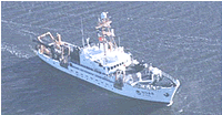 Delaware II |
| Survey Equipment | Survey Info | Data Type(s) | Data Collected |
|---|---|---|---|
| Trawl | --- | Biology | |
| Dredge | --- | Biology Geology | |
| CTD 19+ with OBS, PAR, DO, Chl | --- | CTD | |
| SeaBOSS | --- | Surveys (biological) Experiments (biological) Species ID Photo Video Geology Biology | 2001-015-FA-SC-001 (GRAB samples) |
| Digital camera | --- | Photo | 2001-015-FA-PH-002 (Deck photos of field activity operations) |
| Edgetech DF-1000 sidescan sonar | --- | Sidescan | |
| P-code GPS | --- | Navigation |
