Other ID: M1-02-NC, M102NC, M-01-02-NC
Status: Completed
Organization(s): USGS, Woods Hole Coastal and Marine Science Center
Funding Program(s):
Principal Investigator(s): Marilyn ten Brink
Affiliate Investigator(s): Ian Hartwell (NOAA)
Information Specialist(s): Ellen Mecray
Data Type(s): Imagery: Photo, Imagery: Video, Sampling: Biology, Sampling: Chemistry, Sampling: Geology
Scientific Purpose/Goals: Collaborate with NOAA NS&T and Sanctuary programs and with Western CMGP to collect sediment grab samples on the central California shelf for analysis of sediment texture, chemical composition, and accumulation of contaminants.
Vehicle(s):
Start Port/Location: San Francisco, CA
End Port/Location: San Francisco, CA
Start Date: 2002-02-28
End Date: 2002-03-06
Equipment Used: Digital camera, Grab sampler, Push corer (wh), Video camera - deep sea, Van Veen grab sampler, Plankton nets, Niskin bottle
Information to be Derived:
Summary of Activity and Data Gathered: On 10/21/2003, proprietorship of 58 dried samples was transferred to Donell Frank at B&B Laboratories in College Station, Texas for permanent storage. For more information, contact Donell Frank. per Jim Bischoff. Owens Lake subsamples can be shipped to Denver. Core material is already in Denver. Location of core is: 36deg22.85'N, 117deg57.95'W.
Staff: Dann Blackwood
Affiliate Staff:
Michael Torresan; Ian Hartwell (Chief Scientist and NOAA PI) - NOAA ST&T program; 3 program staff; 4 NOAA Sanctuary staff
Notes: Cruise is in response to a short-notice request for assistance from NOAA to collect deep water samples. Original Center People field contained: Dann Blackwood: deployment of gear, photography of sediment/sea floor, and collection of sediment samples; Michael Torresan.
Location:
Farallon Islands, San Francisco, Monterey Bay, California, United States, North America, North Pacific;
| Boundaries | |||
|---|---|---|---|
| North: 37.95185 | South: 36.60671 | West: -123.449 | East: -121.60767 |
Platform(s):
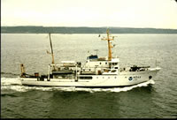 McArthur |
| Title | Survey Equipment | Description |
|---|---|---|
| Sample log | (document not focused on specific equipment) | Sample Log with time, water depth, subsample specifications, sample description. Also includes CTD log with station locations, depth, and comments. |
| Survey Equipment | Survey Info | Data Type(s) | Data Collected |
|---|---|---|---|
| Digital camera | --- | Photo | 2002-028-FA-PH-002 (Deck photos of field activity operatio) |
| Grab sampler | --- | Biology Geology | 2002-028-FA-PH-001 (CD ROM disk of DECK GRABS FARALLONS, ) 2002-028-FA-NL-002 (CD ROM disk of DECK GRABS FARALLONS, ) |
| Push corer (wh) | --- | Biology Geology | 2002-028-FA-SC-001 (CORE samples) |
| Video camera - deep sea | --- | Video | |
| Van Veen grab sampler | --- | Geology | |
| Plankton nets | --- | Biology | |
| Niskin bottle | --- | Chemistry |
