Other ID: OC384
Status: Completed
Organization(s): USGS, Woods Hole Coastal and Marine Science Center
Funding Program(s):
Principal Investigator(s): Page Valentine
Affiliate Investigator(s): Tom Noji/Vince Guida - NMFS, Sandy Hook, NJ
Information Specialist(s): Page Valentine
Data Type(s): Imagery: Photo, Sampling: Biology, Sampling: Geology
Scientific Purpose/Goals: Monitor the benthic habitat and fish productivity on the outer continental shelf adjacent to the Hudson Canyon, comparing areas of varying depth and varying degrees of disturbance by commercial trawling. Using underwater video and photographic techniques, characterize the topography of tilefish habitat for use in estimating tilefish and other fish populations and as a reconnaissance for submersible experiments with tilefish and other fisheries species, and characterize the state of disturbance along Great South Channel and adjacent Nantucket Lightship Closed Area.
Vehicle(s):
Start Port/Location: Woods Hole, MA
End Port/Location: Woods Hole, MA
Start Date: 2002-10-24
End Date: 2002-11-04
Equipment Used: Dredge, Camera- deep sea, Digital camera, Van Veen grab sampler
Information to be Derived: Grain size analysis;
Summary of Activity and Data Gathered: Total of 80 stations occupied; 23 sediment samples; 48 biological samples; 32 video transects; 32 photo transects.
Staff: Dann Blackwood, Madhavi Mamidipalli, Page Valentine
Affiliate Staff:
NOAA/NMFS: Vince Guida - Ch. Sci.
Christine Esteves
Cristina Bascunan
Michael Fahey
Robert Pikanowski
John Hilbert
Jr.
Maureen Taylor
Sandra Sutherland; WHOI: Steven Eykelhoff
Notes: Original Center People field contained: Page Valentine, Dann Blackwood, Durgamadhavi Mamidipalli.
Project = Hudson Canyon Shelf Benthic Habitats Studies, Hudson Canyon Shelf Benthic Habitats Studies
Location:
mid-Atlantic continental shelf, Hudson Canyon, New Jersey, Great South Channel, United States, North America, North Atlantic;
| Boundaries | |||
|---|---|---|---|
| North: 39.71974625 | South: 39.25659631 | West: -72.68998229 | East: -72.08223214 |
Platform(s):
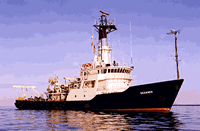
 Oceanus |
| Survey Equipment | Survey Info | Data Type(s) | Data Collected |
|---|---|---|---|
| Dredge | --- | Biology Geology | |
| Camera- deep sea | --- | Photo | |
| Digital camera | --- | Photo | 2002-032-FA-PH-002 (Deck photos of field activity operations) |
| Van Veen grab sampler | --- | Geology | 2002-032-FA-SC-001 (GRAB samples) |