Other ID: Leg 2
Status: Completed
Organization(s): USGS, Woods Hole Coastal and Marine Science Center
Funding Program(s):
Principal Investigator(s): Kathryn Scanlon Catanach
Affiliate Investigator(s): Chris Koenig, Florida State University, Tallahassee, FL
Information Specialist(s): Kathryn Scanlon Catanach
Data Type(s): Imagery: Video, Location-Elevation: Navigation
Scientific Purpose/Goals: To complete collection of sea floor video data begun on REEFS1 cruise FA 03036 in September 2003. Video data were collected using Sony mini-DV camera on a towed camera sled. These data will be used in conjunction with existing sidescan sonar, multibeam, sedimentologic, and biologic data to create habitat maps.
Vehicle(s):
Start Port/Location: Panama City, FL
End Port/Location: Panama City, FL
Start Date: 2003-11-20
End Date: 2003-11-24
Equipment Used: Video camera - deep sea, GPS - Handheld
Information to be Derived: Habitat maps;
Summary of Activity and Data Gathered: This cruise was a continuation of FA 03036 which was aborted because of bad weather and ship engine problems. Although we had the FSU ROV onboard we did not use it. All data on this leg were collected using the towed camera sled Rose Bud carrying a Sony mini-DV camera with lasers spaced 20 cm apart and the Helios underwater video lighting system. As on Leg 1, the sled was towed at about 1 kt for 45 minutes. Sites were numbered consecutively with Leg 1, beginning with Site 14 and ending on Site 28. Sites 14-25 were in Steamboat Lumps Reserve; Sites 26-28 were in Madison Swanson Reserve. Data quality was very good to excellent except at Site 15 which was very poorly focused.
Staff: Kathryn Scanlon Catanach
Affiliate Staff:
Chris Koenig
Florida State University
Co-Chief Scientist
Notes:
Project = Shelf-edge Habitats, Shelf-edge Habitats
Location:
Madison Swanson Marine Reserve, Steamboat Lumps Marine Reserve, West Florida Shelf, Florida, United States, Gulf of Mexico, North America, North Atlantic;
| Boundaries | |||
|---|---|---|---|
| North: 29.333 | South: 28.033 | West: -85.833 | East: -84.5 |
Platform(s):
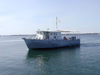 Reefs1 |
Coleman, F.C., Koenig, Christopher C., Scanlon, Kathryn M., Heppell, Scott, Heppell, Selina, and Miller, Margaret W., 2010, Benthic habitat modification through excavation by red grouper, Epinephelus morio, in the northeastern Gulf of Mexico: The Open Fish Science Journal, v. 3, doi: 10.2174/1874401X01003010001.
| Title | Survey Equipment | Description |
|---|---|---|
| Video log | Video camera - deep sea | Koenig sled video log including waypoint locations, date, time, sketch of system configuration, and station descriptions. |
| Survey Equipment | Survey Info | Data Type(s) | Data Collected |
|---|---|---|---|
| Video camera - deep sea | --- | Video | 2003-050-FA-VD-001 (DVD ROM disk of MADISON-SWANSON ) |
| GPS - Handheld | --- | Navigation | 2003-050-FA-LN-001 (Video transect trackchart for REEFS1 03036 and 03050. Transects 1-13 completed during REEFS1 03036 in Madison-Swanson Reserve. Transects 14-27 conducted during REEFS1 03050 in both Madison-Swanson and Steamboat Lumps Reserves.) |
