Other ID: none
Status: Completed
Organization(s): USGS, Woods Hole Coastal and Marine Science Center
Funding Program(s):
Principal Investigator(s): John Bratton
Affiliate Investigator(s):
Information Specialist(s): John Bratton
Data Type(s): Electro-Magnetic: Resistivity, Location-Elevation: Navigation, Sonar: Single Beam, Environmental Data: CTD
Scientific Purpose/Goals: Electrical resistivity surveying and radium/radon sampling.
Vehicle(s):
Start Port/Location: Town Cove, Orleans, MA
End Port/Location: Ryders Cove, Chatham, MA
Start Date: 2004-05-17
End Date: 2004-05-20
Equipment Used: AGI SuperSting, GPS (wh), YSI Sound velocity CTD (wh), Echosounder
Information to be Derived:
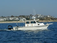
Summary of Activity and Data Gathered: Work was in very shallow water as well as nearshore open ocean. R/V HAENI from USGS-CT was used in Nauset Marsh-Town Cove-Salt Pond (on 5/17), and in Pleasant Bay (5/18-19). R/V RAFAEL was used 1 day (5/20; note: unusually calm seas) for open water work from Chatham Inlet to Highland Light (Truro) and back (offset 100 m east on southbound survey). WHSC YSI CTD was damaged on 5/18 in Pleasant Bay and a replacement borrowed from WHOI was not deployed properly on 5/19-20 so only spot salinity and temp measurements are available. Resistivity data were collected and processed using Marine Log Manager and EarthImager software from AGI, Inc. Emile Bergeron oversaw collection and VeeAnn Cross performed post-cruise processing. Abstract prepared for Coastal Geotools Conference, March 7-10, 2005, Myrtle Beach, SC: INTEGRATION OF CONTINUOUS RESISTIVITY PROFILING AND SEISMIC REFLECTION DATA IN THE NEARSHORE ENVIRONMENT; VeeAnn A. Cross, David S. Foster, John F. Bratton U.S. Geological Survey, Woods Hole, MA; Keywords: groundwater, resistivity profiling, seismic reflection, 3D mapping, nearshore; ABSTRACT-- Groundwater discharging to bays and estuaries is of concern because it often contains elevated concentrations of nutrients and other pollutants that affect coastal ecosystems. Saltwater intruding into coastal aquifers due to excessive pumping has also affected water supplies of coastal communities. Commonly underrepresented in groundwater studies is the understanding of the geometry and stratigraphic control of groundwater flow systems beneath coastal water bodies. This issue is addressed with the use of continuous resistivity profiling (CRP) and seismic reflection data. The CRP system was used to map the freshwater-saltwater interface in the subseafloor environment of outer Cape Cod, Massachusetts. An AGI SuperSting Marine system was used, which consisted of a DC power source, an electrode streamer cable, a GPS receiver, a fathometer, and shipboard logging software. Collected data were processed with an inversion program, AGI EarthImager 2D. Using a combination of GIS software packages, including ArcGIS (ESRI) and EarthVision (Dynamic Graphics), these processed data were integrated with subsurface geology as interpreted from results of previous seismic reflection surveys and onshore drilling. This data integration resulted in a 3D representation of the groundwater system where its relationship to the subsurface geology in the sub-aqueous environment, including confining units and preferential flow conduits, can be examined in greater detail. This approach can be applied to other marine/estuarine areas to characterize groundwater flow in the nearshore environment.
Staff: Emile Bergeron, John Bratton, David Foster, Barry Irwin, Dirk Koopmans
Affiliate Staff:
Eric White
USGS-WRD-Storrs
CT
resistivity technician (5/17 only); Henry Lind and asst.
Eastham Conservation Officer
navigation guide (5/17 only)
Notes: Original Center People field contained: John Bratton, chief scientist; Dave Foster, HAENI boat driver and navigator; Emile Bergeron, geophysical instrumentation operator; Barry Irwin, RAFAEL boat driver; Dirk Koopmans, mobilization/demobilization.
Project = Atlantic Coastal Ground-Water: Cape Cod Natl Seashore, Atlantic Coastal Ground-Water: Cape Cod Natl Seashore
Location:
Cape Cod National Seashore, Massachusetts, United States, North America, North Atlantic;
| Boundaries | |||
|---|---|---|---|
| North: 42.0194 | South: 41.6499 | West: -70.0355 | East: -69.9039 |
Platform(s):
 Rafael | Haeni |
Bratton, J.F., 2007, The importance of shallow confining units to submarine groundwater flow, in Sanford, W., Langevin, C., Polemio, M., and Povinec, P., eds., A New Focus on Groundwater-Seawater Interactions: International Association of Hydrological Sciences, v. 312.
Bratton, J.F., 2010, The three scales of submarine groundwater flow and discharge across passive continental margins: The Journal of Geology, v. 118 no. 5, doi: 10.1086/655114.
Cross, V.A., Bratton, J.F., Crusius, J., Colman, J.A., and McCobb, T.D., 2008, Submarine hydrogeological data from Cape Cod National Seashore: U.S. Geological Survey Open-File Report 2006-1169, DVD, https://doi.org/10.3133/ofr20061169.
| Survey Equipment | Survey Info | Data Type(s) | Data Collected |
|---|---|---|---|
| AGI SuperSting | --- | Resistivity | |
| GPS (wh) | --- | Navigation | |
| YSI Sound velocity CTD (wh) | --- | CTD | |
| Echosounder | --- | Single Beam |