Other ID: OC406-2
Status: Completed
Organization(s): USGS, Woods Hole Coastal and Marine Science Center
Funding Program(s):
Principal Investigator(s): Christopher Sherwood
Affiliate Investigator(s): Chuck Nittrouer, University of Washington
Information Specialist(s):
Data Type(s): Location-Elevation: Navigation, Environmental Data: CTD, Environmental Data: Temperature, Time Series: Mooring (physical oceanography), Environmental Data: Current
Scientific Purpose/Goals: Deploy bottom tripod and guard buoys for EuroSTRATAFORM experiment.
Vehicle(s):
Start Port/Location: Port la Nouvelle, France
End Port/Location: Port la Nouvelle, France
Start Date: 2004-09-23
End Date: 2004-10-01
Equipment Used: GPS (wh), Temperature and salinity, Pressure, Turbidity, Current, ADCP
Information to be Derived:
Summary of Activity and Data Gathered: Extensive Chirp subottom lines collected by Mike Field. Tripods deployed for Spanish and Univ. of Washington co-investigators. Problems with French clearance meant USGS tripod was not deployed and returned to U.S. on OCEANUS.
Staff: Marinna Martini, Christopher Sherwood, Jonathan Borden, Stephen Ruane
Affiliate Staff:
Joanne Ferreira (USGS-Menlo Park)
Technician; Chuck Nittrouer
Univ. of Washington
Project Chief Scientist; Mike Field
USGS
Project PI; Homa Lee
USGS
Project PI
Notes: First of three-leg deployment. Three USGS scientific parties on various legs (Field and Lee are PIs on other projects). This covers only work from Woods Hole, with Sherwood as PI. Original Center People field contained: Chris Sherwood, Scientist; Jon Borden (mobilization in Woods Hole); Marinna Martini (mobilization in Woods Hole); Steve Ruane (mobilization in Woods Hole).
Project = EuroSTRATAFORM - Gulf of Lions, EuroSTRATAFORM - Gulf of Lions
Location:
Golfe du Lyon, France, Mediterranean Sea, Europe;
| Boundaries | |||
|---|---|---|---|
| North: 43.66667 | South: 42 | West: 3 | East: 5 |
Platform(s):
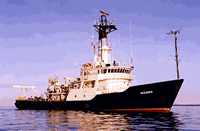
 Oceanus |
| Survey Equipment | Survey Info | Data Type(s) | Data Collected |
|---|---|---|---|
| GPS (wh) | --- | Navigation | |
| Temperature and salinity | --- | CTD Temperature | |
| Pressure | --- | Mooring (physical oceanography) | |
| Turbidity | --- | Mooring (physical oceanography) | |
| Current | --- | Mooring (physical oceanography) | |
| ADCP | --- | Current |