Other ID: none
Status: Completed
Organization(s): USGS, Woods Hole Coastal and Marine Science Center
Funding Program(s):
Principal Investigator(s): E. Robert Thieler
Affiliate Investigator(s): Paul Gayes, CCU
Information Specialist(s): Erika Hammar-Klose
Data Type(s): Imagery: Photo, Location-Elevation: Navigation, Sampling: Geology
Scientific Purpose/Goals: Core inner shelf during the day, run boomer at night.
Vehicle(s):
Start Port/Location: Charleston, SC
End Port/Location: Charleston, SC
Start Date: 2004-10-18
End Date: 2004-10-29
Equipment Used: Alpine Vibracorer, Digital camera, DGPS
Information to be Derived: Depositional history;
Summary of Activity and Data Gathered: Weather was terrible. Hid in the lee and took cores in northern Onslow Bay. 30 cores total. No seismic profiling.
Staff: Emily Himmelstoss, E. Robert Thieler, Charles Worley
Affiliate Staff:
Gayes
Gielstra
et al. (CCU)
Hoffman and Pierson (NCGS); Vibracoring operations
Notes: Cores being housed at NC Geological Survey, Raleigh, NC. Original Center People field contained: Rob Thieler, Co-PI; Emily Himmelstoss, Scientist; Chuck Worley, Marine Technician.
Project = North Carolina Regional Coastal Erosion Studies, North Carolina Regional Coastal Erosion Studies
Location:
Charleston, South Carolina, United States, North America, North Atlantic;
| Boundaries | |||
|---|---|---|---|
| North: 35.38705942 | South: 34.90995974 | West: -76.73235509 | East: -75.19889166 |
Platform(s):
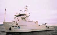 Nancy Foster |
| Survey Equipment | Survey Info | Data Type(s) | Data Collected |
|---|---|---|---|
| Alpine Vibracorer | --- | Geology | 2004-044-FA-SC-001 (core samples) |
| Digital camera | --- | Photo | 2004-044-FA-PH-001 (Deck photos of field activity operations) |
| DGPS | --- | Navigation |
