Other ID: none
Status: Completed
Organization(s): USGS, Woods Hole Coastal and Marine Science Center
Funding Program(s):
Principal Investigator(s): E. Robert Thieler
Affiliate Investigator(s):
Information Specialist(s): E. Robert Thieler
Data Type(s): Sonar: Single Beam, Location-Elevation: Navigation
Scientific Purpose/Goals: Map shoreline position.
Vehicle(s):
Start Port/Location:
End Port/Location:
Start Date: 2005-12-04
End Date: 2005-12-10
Equipment Used: Echosounder, GPS (wh)
Information to be Derived: Bathymetric maps;
Summary of Activity and Data Gathered: Shoreline walks with GPS backpack for shoreline position; one day bathymetric survey of nearshore.
Staff: Barry Irwin, E. Robert Thieler
Affiliate Staff:
Milton Carlo - UPR
Captain and Field Scientist
Notes: Original Center People field contained: Rob Thieler, PI; Barry Irwin, Geodesist.
Project = Rincon Puerto Rico Coastal Erosion Study, Rincon Puerto Rico Coastal Erosion Study
Location:
Rincon, Puerto Rico, Caribbean, United States, North America, North Atlantic;
| Boundaries | |||
|---|---|---|---|
| North: 18.4 | South: 18.2 | West: -67.3 | East: -67.2 |
Platform(s):
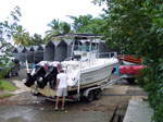 Camille |
Thieler, E.R., Rodriguez, R.W., and Himmelstoss, E.A., 2008, Historical shoreline changes at Rincon, Puerto Rico, 1936-2006, U.S. Geological Survey Open-File Report 2007-1017, https://doi.org/10.3133/ofr20071017.
| Survey Equipment | Survey Info | Data Type(s) | Data Collected |
|---|---|---|---|
| Echosounder | --- | Single Beam | |
| GPS (wh) | --- | Navigation |
