Other ID: none
Status: Completed
Organization(s): USGS, Woods Hole Coastal and Marine Science Center
Funding Program(s):
Principal Investigator(s): John Bratton
Affiliate Investigator(s):
Information Specialist(s): VeeAnn Cross
Data Type(s): Environmental Data: CTD, Environmental Data: Temperature, Electro-Magnetic: Resistivity, Location-Elevation: Navigation
Scientific Purpose/Goals: CRP surveying in Salt Pond/Nauset Marsh at CCNS.
Vehicle(s):
Start Port/Location: Salt Pond, Eastham, MA
End Port/Location: Salt Pond, Eastham, MA
Start Date: 2006-02-28
End Date: 2006-02-28
Equipment Used: Temperature and salinity, AGI SuperSting, YSI Sound velocity CTD (wh), GPS (wh)
Information to be Derived:
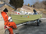
Summary of Activity and Data Gathered: Fifteen lines of data were collected, with approximately 7 in Salt Pond and 8 in the northern half of Nauset Marsh. The cruise was scheduled to take advantage of the unusually high proxigean tide at about 11:30 AM which permitted access to parts of the marsh that would have otherwise not been navigable. Part of the planned survey area (esp. the eastern half of Salt Pond) could not be navigated due to moderately thick ice. The rest of the area was either open water, or was covered by only a thin layer of ice that could be penetrated by the boat. Data were collected with the 50-m streamer by a team on land holding the end of the streamer and stretching the streamer out until the boat could pull it tight and start collecting data. Data processing began on March 1 and incorporated water conductivity measurements and fathometer data into the processing of resistivity lines. Results will be communicated to WRD collaborators to guide modeling efforts. Additional vibracoring and porewater squeezing is also planned for spring/summer 2006 based on results of this survey.
Staff: John Bratton, VeeAnn Cross, David Foster, Charles Worley
Affiliate Staff:
Notes: Original Center People field contained: John Bratton, chief scientist; Charles Worley, CRP system operator; Dave Foster, boat driver; VeeAnn Cross, navigation specialist.
Project = Coastal Groundwater Systems, Coastal Groundwater Systems
Location:
Salt Pond, Nauset Marsh, Cape Cod National Seashore, Massachusetts, United States, North America, North Atlantic;
| Boundaries | |||
|---|---|---|---|
| North: 41.85 | South: 41.8 | West: -69.97 | East: -69.92 |
Platform(s):
 Terrapin |
Bratton, J.F., 2007, The importance of shallow confining units to submarine groundwater flow, in Sanford, W., Langevin, C., Polemio, M., and Povinec, P., eds., A New Focus on Groundwater-Seawater Interactions: International Association of Hydrological Sciences, v. 312.
Bratton, J.F., 2010, The three scales of submarine groundwater flow and discharge across passive continental margins: The Journal of Geology, v. 118 no. 5, doi: 10.1086/655114.
Cross, V.A., Bratton, J.F., Crusius, J., Colman, J.A., and McCobb, T.D., 2008, Submarine hydrogeological data from Cape Cod National Seashore: U.S. Geological Survey Open-File Report 2006-1169, DVD, https://doi.org/10.3133/ofr20061169.
| Survey Equipment | Survey Info | Data Type(s) | Data Collected |
|---|---|---|---|
| Temperature and salinity | --- | CTD Temperature | |
| AGI SuperSting | --- | Resistivity | |
| YSI Sound velocity CTD (wh) | --- | CTD | |
| GPS (wh) | --- | Navigation |
