Other ID: none
Status: Completed
Organization(s): USGS, Woods Hole Coastal and Marine Science Center
Funding Program(s):
Principal Investigator(s): Uri Ten Brink
Affiliate Investigator(s): NOAA-PMEL
Information Specialist(s): William Danforth
Data Type(s): Sonar: Multibeam, Environmental Data: Temperature, Location-Elevation: Navigation
Scientific Purpose/Goals: Sea floor mapping of the Mona Passage using multibeam sonar. Deploy 5 OBSes in the Puerto Rico Trench.
Vehicle(s):
Start Port/Location: San Juan, Puerto Rico
End Port/Location: Mayaguez, Puerto Rico
Start Date: 2007-03-14
End Date: 2007-03-26
Equipment Used: Simrad EM1002, XBT, DGPS
Information to be Derived: Bathymetric maps; Morphology;
Summary of Activity and Data Gathered: Collected over 4200 km2 of multibeam bathymetry data at a grid spacing of 30 m.
Staff: Brian Andrews, William Danforth, Claudia Flores, Uri Ten Brink
Affiliate Staff:
Christopher Chamberlin - NOAA PMEL/JISAO
Brooke McMahon - NOAA PHB
Kelly Carrignan - NOAA NGDC/CIRES
Jason Chaytor - WHOI/USGS post-doc
Notes: Original Center People field contained: Uri ten Brink - Chief Scientist; William Danforth; Brian Andrews; Claudia Flores.
Project = Tsunami and earthquake hazards in the NE Caribbean, Tsunami and earthquake hazards in the NE Caribbean
Location:
Puerto Rico, the U.S. Virgin Islands, and the Dominican Republic, northeast Caribbean, North Atlantic;
| Boundaries | |||
|---|---|---|---|
| North: 19 | South: 17.83333 | West: -68.6667 | East: -67 |
Platform(s):
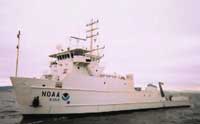 Nancy Foster |
Lopez-Venegas, A.M., ten Brink, U.S., and Geist, E.L., 2008, Submarine landslide as the source for the October 11, 1918 Mona Passage tsunami; observations and modeling: Marine Geology, v. 254 no. 1-2, doi: 10.1016/j.margeo.2008.05.001.
ten Brink, U.S., Marshak, Stephen, and Granja Bruna, Jose-Luis, 2009, Bivergent thrust wedges surrounding oceanic island arcs; insight from observations and sandbox models of the northeastern Caribbean plate: Geological Society of America Bulletin, v. 121 no. 11-12, doi: 10.1130/B26512.1.
| Survey Equipment | Survey Info | Data Type(s) | Data Collected |
|---|---|---|---|
| Simrad EM1002 | --- | Multibeam | |
| XBT | --- | Temperature | |
| DGPS | --- | Navigation |
