Other ID: none
Status: Completed
Organization(s): USGS, Woods Hole Coastal and Marine Science Center
Funding Program(s):
Principal Investigator(s): Lawrence Poppe
Affiliate Investigator(s): George Sennefelder, NMFS, NOAA
Information Specialist(s): Lawrence Poppe
Data Type(s): Biological Field Study: Experiments (biological), Biological Field Study: Surveys (biological), Imagery: Photo, Imagery: Video, Location-Elevation: Navigation, Sampling: Biology, Sampling: Geology, Visual Identification: Species ID
Scientific Purpose/Goals: Map distributions of shell-bed habitat adjacent to point-associated shoals.
Vehicle(s):
Start Port/Location: Milford, CT
End Port/Location: Milford, CT
Start Date: 2007-08-06
End Date: 2007-08-10
Equipment Used: DGPS, SeaBOSS, Digital camera
Information to be Derived: Grain size analysis; Habitat maps; Sea floor map; Morphology;
Summary of Activity and Data Gathered: Cruise was conducted in concert with the Teacher Research Experience Program; five middle-high school teachers and two students participated. Bottom photography/sampling stations were occupied in support of three projects: 1) Roanoke and Herod Points - 23 stations - study of shellbed composition and distribution adjacent to shore-attached, cape-associated shoals; 2) Charles Island Shoal - 18 stations - habitat variability appraisal for Ron Goldberg (NMFS-Milford); and 3) East Shoal - 6 stations - investigation of sessile forms on an isolated rocky bathymetric high east of Stratford Shoal for Peter Auster (NURC-NOAA).
Staff: Dann Blackwood, Lawrence Poppe
Affiliate Staff:
George Sennefelder
NMFS-NOAA
biologist; Ivar Babb
NURC-NOAA
biologist
Notes: This cruise is affiliated with and partly supported by the NURC Teacher-Research Experience (TRE) Program. Program sponsers include the Connecticut Department of Environmental Protection, Connecticut Sea Grant, and the University of Connecticut. Original Center People field contained: Larry Poppe; Dann Blackwood, photographer and SEABOSS tech.
Location:
Long Island Sound, New York, Connecticut, United States, North America, North Atlantic,
| Boundaries | |||
|---|---|---|---|
| North: 41.18833 | South: 40.95 | West: -72.9167 | East: -72.63333 |
Platform(s):
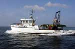 Loosanoff |
| Survey Equipment | Survey Info | Data Type(s) | Data Collected |
|---|---|---|---|
| DGPS | --- | Navigation | |
| SeaBOSS | --- | Surveys (biological) Experiments (biological) Species ID Photo Video Geology Biology | 2007-019-FA-VD-001 (4 Hi-8 cassette tapes of bottom video from Charles Island, Roanoke Point, and Herod Point, Long Island Sound) 2007-019-FA-VD-001-01 (7 DVDs of bottom video from Roanoke Point and Herod Point, Long Island Sound) 2007-019-FA-PH-002 (2 DVDs of bottom photos from Charles Island, Roanoke Point, and Herod Point, Long Island Sound.) 2007-019-FA-SC-001 (grab samples) |
| Digital camera | --- | Photo | 2007-019-FA-PH-001 (Deck photos of field activity operations) |
