Other ID: T-1-09-PR
Status: Completed
Organization(s): USGS, Woods Hole Coastal and Marine Science Center
Funding Program(s):
Principal Investigator(s): Uri Ten Brink
Affiliate Investigator(s):
Information Specialist(s): Brian Andrews
Data Type(s): Imagery: Video, Location-Elevation: Navigation, Seismics: Sparker, Sonar: Interferometric
Scientific Purpose/Goals: Map faults on the Virgin Islands platform.
Vehicle(s):
Start Port/Location: St. Thomas, U.S. Virgin Islands
End Port/Location: St. Thomas, U.S. Virgin Islands
Start Date: 2009-03-22
End Date: 2009-04-10
Equipment Used: Sparker , Single channel hydrophone, Digital video camera, SEA SWATHplus-M 234 kHz, GPS (wh)
Information to be Derived: Sea floor map; Bathymetric maps; Morphology;
Summary of Activity and Data Gathered: Collected 1,311 kilometers of 234 kHz SwathPlus interferometric bathymetry over 10 survey days. Collected 821 kilometers of mini-sparker seismic reflection profiles over 9 survey days.
Staff: Brian Andrews, Emile Bergeron, William Danforth, Uri Ten Brink, Charles Worley
Affiliate Staff:
Notes: Original Center People field contained: Uri ten Brink - chief scientist; Bill Danforth - processing chief; Brian Andrews - GIS chief; Chuck Worley - Interferometric side-scan chief; Emile Bergeron - Sparker chief; No Indians.
Project = Tsunami Hazards: Dev. of Source Potential, Tsunami Hazards: Dev. of Source Potential
Location:
Puerto Rico, the Virgin Islands, and the Dominican Republic, northeast Caribbean, North Atlantic,
| Boundaries | |||
|---|---|---|---|
| North: 18.8086 | South: 18.136 | West: -65.2747 | East: -64.2702 |
Platform(s):
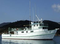 Tiki XIV |
| Survey Equipment | Survey Info | Data Type(s) | Data Collected |
|---|---|---|---|
| Sparker | --- | Sparker | |
| Single channel hydrophone | --- | Air Gun / Water Gun Boomer Bubble Gun Sparker Sub Bottom Profiler | |
| Digital video camera | --- | Video | |
| SEA SWATHplus-M 234 kHz | --- | Interferometric | |
| GPS (wh) | --- | Navigation |
