Other ID: none
Status: Completed
Organization(s): USGS, Woods Hole Coastal and Marine Science Center
Funding Program(s):
Principal Investigator(s): Lawrence Poppe
Affiliate Investigator(s): CT-DEP
Information Specialist(s): Lawrence Poppe
Data Type(s): Biological Field Study: Experiments (biological), Biological Field Study: Surveys (biological), Imagery: Photo, Imagery: Video, Location-Elevation: Navigation, Sampling: Biology, Sampling: Geology, Visual Identification: Species ID
Scientific Purpose/Goals: Ground truth NOAA surveys H11251, H11445, H11446, H11997, H11999 and H12013 in eastern Long Island Sound with bottom sampling and photography. Field work was focused on the sampling/photography.
Vehicle(s):
Start Port/Location: Groton, CT
End Port/Location: Groton, CT
Start Date: 2009-11-09
End Date: 2009-11-11
Equipment Used: SeaBOSS, Digital camera, HYPACK
Information to be Derived: Grain size analysis; Sea floor map; Morphology;
Summary of Activity and Data Gathered: Video and still photographs were collected at 41 stations; samples were collected at 27 of the stations. Ground truthing of survey H11445 was completed; ground truthing of surveys H11251 and H12013 was partly completed. Cruise was originally planned for 7 days, but remnants of Hurricane Ida increased the sea state and terminated field operations.
Staff: Dann Blackwood, Barry Irwin, Katherine McMullen, Lawrence Poppe
Affiliate Staff:
Notes: SEABOSS used was the mini-SEABOSS. Original Center People field contained: Larry Poppe - Scientist; Kate McMullen - Field and Lab Tech; Dann Blackwood - Photographer; Barry Irwin - Boat Operator.
Project = Sea and Lake Floor Mapping: Data off Cape Cod, Sea and Lake Floor Mapping: Data off Cape Cod
Location:
Long Island Sound, New York, Connecticut, United States, North America, North Atlantic,
| Boundaries | |||
|---|---|---|---|
| North: 41.25 | South: 41 | West: -72.5 | East: -72.13333 |
Platform(s):
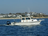
 Rafael |
McMullen, K.Y., Poppe, L.J., Danforth, W.W., Blackwood, D.S., Schaer, J.D., Ostapenko, A.J., Glomb, K.A., and Doran, E.F., 2010, Surficial geology of the sea floor in Long Island Sound offshore of Plum Island, New York: U.S. Geological Survey Open-File Report 2010-1005, https://doi.org/10.3133/ofr20101005.
Poppe, L.J., McMullen, K.Y., Ackerman, S.D., Guberski, M.R., and Wood, D.A., Sea-Floor Character and Sedimentary Processes Offshore of the Connecticut River, Northeastern Long Island Sound [abs.]: , 2013 GSA Meeting. Denver, CO, October 27-30, 2013.
Poppe, L.J., Danforth, W.W., McMullen, K.Y., Parker, C.E., and Doran, E.F., 2011, Combined multibeam and LIDAR bathymetry data from eastern Long Island Sound and westernmost Block Island Sound-A regional perspective: U. S. Geological Survey Open-File Report 2011-1003, https://doi.org/10.3133/ofr20111003.
Poppe, L.J., McMullen, K.Y., Ackerman, S.D., Blackwood, D.S., Irwin, B.J., Schaer, J.D., Lewit, P.G., and Doran, E.F., 2010, Sea-floor geology and character offshore of Rocky Point, New York: U.S. Geological Survey Open-File Report 2010-1007, https://doi.org/10.3133/ofr20101007.
Poppe, L.J., McMullen, K.Y., Ackerman, S.D., Guberski, M.R., and Wood, D.A., 2013, Sea-floor character and geology off the entrance to the Connecticut River, northeastern Long Island Sound: U.S. Geological Survey Open-File Report 2012-1103, https://doi.org/10.3133/ofr20121103.
FAN 2009-059-FA has data viewable in the CMGP Video and Photograph Portal. View the data in this application here. See the instructions for working with this application.
| Title | Survey Equipment | Description |
|---|---|---|
| Sample log | SeaBOSS | Sample log including station location, time, station observations, photos taken. |
| Survey Equipment | Survey Info | Data Type(s) | Data Collected |
|---|---|---|---|
| SeaBOSS | --- | Surveys (biological) Experiments (biological) Species ID Photo Video Geology Biology | 2009-059-FA-PH-001 (Bottom still photos from 41 stations: shot with mini-SeaBOSS camera.) 2009-059-FA-SC-001 (Sediment samples: collected at 27 of 41 stations.) 2009-059-FA-SC-001-01 (Grain Size Analysis: 41 samples. Lab numbers AX388 to AX428.) 2009-059-FA-NL-001-01 (Mini-Seaboss camera-sample log (pdf file)) 2009-059-FA-NL-001 (Sampling-photography log) 2009-059-FA-VD-003 (DVD's of Bottom Video-Eastern Long Island Sound) |
| Digital camera | --- | Photo | 2009-059-FA-PH-002 (Field activity deck photographs) |
| HYPACK | --- | Navigation | 2009-059-FA-LN-001 (Hypack navigation files) |