Other ID: none
Status: Completed
Organization(s): USGS, Woods Hole Coastal and Marine Science Center
Funding Program(s):
Principal Investigator(s): William Schwab
Affiliate Investigator(s):
Information Specialist(s): Seth Ackerman, Brian Andrews
Data Type(s): Environmental Data: CTD, Location-Elevation: Navigation, Seismics: Sub Bottom Profiler, Sonar: Interferometric, Sonar: Multibeam, Sonar: Sidescan, Sonar: Sound Velocity
Scientific Purpose/Goals: The purpose of this survey was to collect high-resolution chirp seismic profiles, swath bathymetry, and sidescan sonar backscatter to characterize the surface and subsurface geologic framework offshore of Massachusetts.
Vehicle(s):
Start Port/Location: Woods Hole, MA
End Port/Location: Woods Hole, MA
Start Date: 2010-05-13
End Date: 2010-06-04
Equipment Used: Real Time Kinematic GPS, Edgetech chirp subbottom profiler 512i, Klein 3000, SEA SWATHplus-M 234 kHz, Sensor - MVP30 (Odim), Temperature and salinity
Information to be Derived:
Summary of Activity and Data Gathered: USGS Survey 10004 (2010-004-FA) was conducted 13 May-4 June, 2010 aboard the M/V MEGAN MILLER in Buzzards Bay and Vineyard Sound, MA. The purpose of this survey was to collect high-resolution chirp seismic profiles, swath bathymetry, and sidescan sonar backscatter to characterize the surface and subsurface geologic framework offshore of Massachusetts. The survey covered a total of 333 sq. km in northern Buzzards Bay and Vineyard Sound, MA.
Staff: Seth Ackerman, Brian Andrews, Wayne Baldwin, Walter Barnhardt, Emile Bergeron, William Danforth, David Foster, Barry Irwin, Aaron Turecek, Charles Worley
Affiliate Staff:
Notes: Leg 1: 13-24 May, 2010; Leg 2: 24 May-4 June, 2010.
Project = Massachusetts Coastal Zone Management (MA CZM) Seafloor Mapping - Buzzards Bay and Vineyard Sound, Massachusetts Coastal Zone Management (MA CZM) Seafloor Mapping - Buzzards Bay and Vineyard Sound
Location:
Buzzards Bay, Vineyard Sound, Massachusetts, United States, North America, North Atlantic;
| Boundaries | |||
|---|---|---|---|
| North: 41.69753 | South: 41.31495 | West: -71.0403 | East: -70.4361 |
Platform(s):
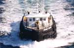 Megan T Miller |
Ackerman, S.D., Andrews, B.D., Foster, D.S., Baldwin, W.E., and Schwab W.C. 2013, High-resolution geophysical data from the inner continental shelf—Buzzards Bay, Massachusetts: U.S. Geological Survey Open-File Report 2012-1002, https://doi.org/10.3133/ofr20121002.
Andrews, B.D., Ackerman, S.D., Baldwin, W.E., Foster, D.S., and Schwab, W.C., 2014, High-resolution geophysical data from the inner continental shelf at Vineyard Sound, Massachusetts (ver. 2.0, September 2014): U.S. Geological Survey Open-File Report 2012-1006, https://doi.org/10.3133/ofr20121006.
| Survey Equipment | Survey Info | Data Type(s) | Data Collected |
|---|---|---|---|
| Real Time Kinematic GPS | --- | Navigation | |
| Edgetech chirp subbottom profiler 512i | --- | Sub Bottom Profiler | 2010-004-FA-SE-001 (Seismic Reflection profiles were collected with Edgetech 512i chirp system.) 2010-004-FA-SE-002 (Seismic data archived on 37 Blu-ray Discs for entire project.) |
| Klein 3000 | --- | Sidescan | 2010-004-FA-SO-002 (Backscatter data collected during the survey, on (37) Blu-Ray discs, contain all data collected during the survey.) |
| SEA SWATHplus-M 234 kHz | --- | Interferometric | |
| Sensor - MVP30 (Odim) | --- | Sound Velocity | |
| Temperature and salinity | --- | CTD Temperature |
