Other ID: none
Status: Completed
Organization(s): USGS, Woods Hole Coastal and Marine Science Center
Funding Program(s):
Principal Investigator(s): Uri Ten Brink
Affiliate Investigator(s):
Information Specialist(s):
Data Type(s): Location-Elevation: Navigation, Seismics: Multichannel, Seismics: Sparker, Visual Identification: Species ID
Scientific Purpose/Goals: Image landslides and buried submarine canyons.
Vehicle(s):
Start Port/Location: Ocean City, MD
End Port/Location: Atlantic City, NJ
Start Date: 2010-05-22
End Date: 2010-05-29
Equipment Used: DGPS, Multichannel seismics, Visual Mammal ID, Sparker
Information to be Derived: Bathymetric maps; Morphology; Landslide and canyon development; Core siting
Summary of Activity and Data Gathered: Source: 6 kiloJoule Sparker, 6 tips, towed at 3 m depth. Receiver: 48-channel Geo-Eel seismic cable. 6.25 m group interval. Cable towed at 3-3.5 m depth. Shot interval: 6 sec. Recording interval: 1-0.5 msec. Record length: 4.5-5.5 sec.
Staff: Jason Chaytor, Claudia Flores
Affiliate Staff:
Mike Barth - contractor; Carol Reiss - marine mammal observer
Notes: Project = Potential Tsunami Sources, Potential Tsunami Sources
Location:
New England continental slope, North Atlantic;
| Boundaries | |||
|---|---|---|---|
| North: 40.1 | South: 39.2 | West: -72.3 | East: -70.5 |
Platform(s):
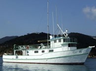 Tiki XIV |
Flores, C.H., Brothers, D.S., ten Brink, U.S., and Chaytor, J.D, 2011, New geophysical constraints on the stratigraphy and structure of the southern New England continental margin [abs.]: , 2011 Fall AGU Meeting. San Francisco, CA, December 5-9, 2011.
| Title | Survey Equipment | Description |
|---|---|---|
| Protected Species Log | (document not focused on specific equipment) | Protected Species Observer report and table of observations. |
| Survey Equipment | Survey Info | Data Type(s) | Data Collected |
|---|---|---|---|
| DGPS | --- | Navigation | |
| Multichannel seismics | --- | Multichannel | |
| Visual Mammal ID | --- | Species ID | 2010-021-FA-NL-001 (Protected Species Observer report and table of observations. ) |
| Sparker | --- | Sparker |
