Other ID: none
Status: Cancelled
Organization(s): USGS, Woods Hole Coastal and Marine Science Center
Funding Program(s):
Principal Investigator(s): William Schwab
Affiliate Investigator(s):
Information Specialist(s): Brian Andrews
Data Type(s): Seismics: Multichannel
Scientific Purpose/Goals: Continue multichannel survey in Buzzards Bay and Vineyard Sound.
Vehicle(s):
Start Port/Location: Woods Hole, MA
End Port/Location: Woods Hole, MA
Start Date: 2010-07-29
End Date: 2010-08-05
Equipment Used: Multichannel seismics
Information to be Derived: Sea floor map;
Summary of Activity and Data Gathered:
Staff: Wayne Baldwin, Emile Bergeron, David Foster, Barry Irwin
Affiliate Staff:
Notes: CRUISE CANCELLED DUE TO GEAR ISSUES. Multichannel seismic data overwhelmed by noise.
Project = Massachusetts Coastal Zone Management (MA CZM) Seafloor Mapping - Buzzards Bay and Vineyard Sound, Massachusetts Coastal Zone Management (MA CZM) Seafloor Mapping - Buzzards Bay and Vineyard Sound
Location:
Cape Cod Bay, Massachusetts, United States, North America, North Atlantic;
| Boundaries | |||
|---|---|---|---|
| North: 41.54353 | South: 41.3232 | West: -70.9992 | East: -70.48553 |
Platform(s):
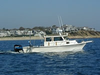
 Rafael |
McMullen, K.Y., Poppe, Lawrence J., Ackerman, Seth D., Danforth, William W., Schaer, Jasper D.,, 2012, Sea-Floor Geology in Long Island Sound, Offshore of the North Fork of Long Island, New York [abs.]: , Long Island Sound Research Conference. Stony Brook, NY, November 1-2, 2012.
| Survey Equipment | Survey Info | Data Type(s) | Data Collected |
|---|---|---|---|
| Multichannel seismics | --- | Multichannel |