Other ID: none
Status: Completed
Organization(s): USGS, Woods Hole Coastal and Marine Science Center
Funding Program(s):
Principal Investigator(s): Carolyn Ruppel
Affiliate Investigator(s):
Information Specialist(s): Carolyn Ruppel
Data Type(s): Environmental Data: Conductivity, Environmental Data: Methane, Environmental Data: Temperature, Location-Elevation: Navigation, Sampling: Geology, Seismics: Sparker, Seismics: Sub Bottom Profiler, Sonar: Interferometric, Sonar: Multibeam, Sonar: Single Beam, Visual Identification: Species ID
Scientific Purpose/Goals: Subbottom imaging shallow offshore Beaufort Sea, water column imaging, seafloor imaging, coring, and real-time water sampling with CRDS.
Vehicle(s):
Start Port/Location: West Dock Prudhoe Bay, AK
End Port/Location: West Dock, Prudhoe Bay, AK
Start Date: 2011-08-01
End Date: 2011-08-12
Equipment Used: YSI multiparameter sonde, HYPACK, EdgeTech 424 chirp sub-bottom profiler, Single channel hydrophone, Visual Mammal ID, SEA SWATHplus-M 234 kHz, Cavity Ring-Down Spectroscopy (CRDS), Sparker , Humminbird fishfinder, Alpine Vibracorer
Information to be Derived: Sea floor map;Bathymetric maps;Morphology;
Summary of Activity and Data Gathered: Acquired 178 km of Chirp, sparker, and Swath data and 110 km of geochemical data, including CH4 and CO2 concentrations, salinity/water temp, and weather data
Staff: Laura Brothers, John Pohlman, Charles Worley
Affiliate Staff:
John Kessler
TAMU
Casey Moore
Stanford student (WHOI Summer Student Fellow)
Katy Sparrow
TAMU
Notes: Cruise dates ~1 through 12 August, with one full port day for equip changeover on 8 August
Project = Natural Gas Hydrates/DOE,
Location:
offshore shallow Beaufort Sea, Alaska, United States, North America, Arctic Ocean;
| Boundaries | |||
|---|---|---|---|
| North: 70.91664 | South: 70.25945 | West: -152.49 | East: -148.07373 |
Platform(s):
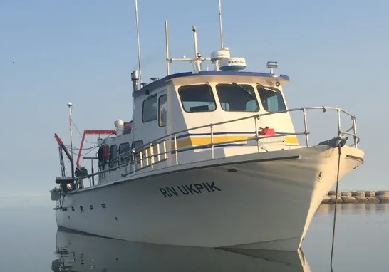 Ukpik |
Ruppel, C., Brothers, L., Hart, P., and Pohlman, J, 2012, Warming-Driven Dissociation of Gas Hydrates on the Continental Shelf and Upper Continental Slope of the US Beaufort Seas [abs.]: , Arctic Frontiers 2012. Tromso, Norway, January 20, 2012.
Ruppel, C., Brothers, L., Hart, P., Maue, C., Pohlman, J., Kessler, J., Sparrow, K.M., and Worley, C, 2012, Methane Dynamics Associated with Long-Term Climate Change on the Alaskan Beaufort Sea Inner-Shelf: DOE, Fire in the Ice Newsletter, .
| Title | Survey Equipment | Description |
|---|---|---|
| Protected Species Log | (document not focused on specific equipment) | Marine Mammal Observer report, polar bear sighting logs. |
| Survey Equipment | Survey Info | Data Type(s) | Data Collected |
|---|---|---|---|
| YSI multiparameter sonde | --- | Conductivity Dissolved Oxygen ORP pH Temperature | |
| HYPACK | --- | Navigation | |
| EdgeTech 424 chirp sub-bottom profiler | --- | Sub Bottom Profiler | |
| Single channel hydrophone | --- | Air Gun / Water Gun Boomer Bubble Gun Sparker Sub Bottom Profiler | |
| Visual Mammal ID | --- | Species ID | 2011-001-FA-NL-001 (Marine Mammal Observer report
Polar Bear logs
Permits obtained
) |
| SEA SWATHplus-M 234 kHz | --- | Interferometric | |
| Cavity Ring-Down Spectroscopy (CRDS) | --- | CO2 Methane Experiments (geochemical) Surveys (geochemical) Chemistry | |
| Sparker | --- | Sparker | |
| Humminbird fishfinder | --- | Single Beam | |
| Alpine Vibracorer | --- | Geology |
