Other ID: none
Status: Completed
Organization(s): USGS, Woods Hole Coastal and Marine Science Center
Funding Program(s):
Principal Investigator(s): Uri Ten Brink
Affiliate Investigator(s):
Information Specialist(s): Claudia Flores
Data Type(s): Location-Elevation: Navigation, Seismics: Sparker, Seismics: Multichannel, Seismics: Sonobuoy, Sonar: Sound Velocity
Scientific Purpose/Goals: high-resolution MCS survey of the continental slope NE of the Hudson canyon. This area is unique along the Atlantic slope in having many landslides and hardly any submarine canyons. The cruise aimed to characterize and tie shelf, slope and rise stratigraphy together. It was also a test cruise for the new MCS streamer purchased by the center
Vehicle(s):
Start Port/Location: WH
End Port/Location: WH
Start Date: 2011-09-20
End Date: 2011-09-26
Equipment Used: Sparker , Multichannel seismics, Seismic refraction, Sensor - MVP30 (Odim), DGPS
Information to be Derived:
Summary of Activity and Data Gathered: 1000 km of continuous seismic reflection data collected by Geometrics digital streamer (GeoEel) with a 6 kjoule Applied Acoustics sparker sound source
Staff: Emile Bergeron, Claudia Flores, Eric Moore, Thomas O'Brien, Uri Ten Brink
Affiliate Staff:
Notes:
Project = NRC/Tsunami Landslide,
Location:
Gulf of Maine, United States, North America, North Atlantic;,
| Boundaries | |||
|---|---|---|---|
| North: 40.68064 | South: 38.82259 | West: -72.5098 | East: -70.35645 |
Platform(s):
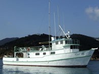 Tiki XIV |
| Survey Equipment | Survey Info | Data Type(s) | Data Collected |
|---|---|---|---|
| Sparker | --- | Sparker | |
| Multichannel seismics | --- | Multichannel | |
| Seismic refraction | --- | Sonobuoy | |
| Sensor - MVP30 (Odim) | --- | Sound Velocity | |
| DGPS | --- | Navigation |
