Other ID: none
Status: Completed
Organization(s): USGS, Woods Hole Coastal and Marine Science Center
Funding Program(s):
Principal Investigator(s): William Schwab
Affiliate Investigator(s): Dan Sampson (Mass CZM)
Information Specialist(s): Seth Ackerman
Data Type(s): Biological Field Study: Experiments (biological), Biological Field Study: Surveys (biological), Imagery: Photo, Imagery: Video, Location-Elevation: Navigation, Sampling: Biology, Sampling: Geology, Visual Identification: Species ID
Scientific Purpose/Goals: This is in response to a request for SeaBOSS for Mass CZM
Vehicle(s):
Start Port/Location: Woods Hole, MA
End Port/Location: Woods Hole, MA
Start Date: 2011-09-09
End Date: 2011-09-16
Equipment Used: DGPS, GoPro camera, Osprey camera system, Digital camera, Van Veen grab sampler, SeaBOSS
Information to be Derived: Grain size analysis;
Summary of Activity and Data Gathered: Sampling survey on the EPA's OSV Bold using the big SEABOSS
Staff: Seth Ackerman, Brian Andrews, Katherine McMullen, Charles Worley
Affiliate Staff:
Notes: Project = MassCZM, MassCZM
Location:
Buzzards Bay, Cape Cod, Massachusetts, United States, North America, North Atlantic;Cape Cod Bay, Massachusetts, United States, North America, North Atlantic;Middle Ground, Vineyard Sound, Marthas Vineyard, Massachusetts, United States, North America, North Atlantic;,
| Boundaries | |||
|---|---|---|---|
| North: 41.99 | South: 41.19 | West: -71.12 | East: -69.9 |
Platform(s):
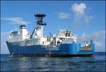 OSV Bold |
Huntley, E.C., Ackerman, S.D., Boeri, R.L., Callaghan, T.P., and Sampson, D.W., 2018, Sampling data collected in Cape Cod Bay, Buzzards Bay, and Vineyard Sound; south of Martha's Vineyard; and south and east of Nantucket, Massachusetts, in 2011, U.S. Geological Survey Field Activity 2011-015-FA: U.S. Geological Survey data release, https://doi.org/10.5066/F73F4NVM.
FAN 2011-015-FA has data viewable in the CMGP Video and Photograph Portal. View the data in this application here. See the instructions for working with this application.
| Title | Survey Equipment | Description |
|---|---|---|
| Cruise log | (document not focused on specific equipment) | Acquisition log maintained during field activity 2011-015-FA by the U.S. Geological Survey and Massachusetts Office of Coastal Zone Management offshore of Massachusetts around Cape Cod and the Islands in September 2011 (PDFs of Excel spreadsheets) |
| Survey Equipment | Survey Info | Data Type(s) | Data Collected |
|---|---|---|---|
| DGPS | --- | Navigation | 2011-015-FA_nav (Text files of the navigation logged during field activity 2011-015-FA by the U.S. Geological Survey and Massachusetts Office of Coastal Zone Management offshore of Massachusetts around Cape Cod and the Islands in September 2011 (ASCII text and CSV files)) |
| GoPro camera | GoPro HD HERO | Photo Video | |
| Osprey camera system | Kongsberg Simrad OE1365 video camera | Photo Video | 2011-015-FA_videos (Location of bottom video tracklines collected during field activity 2011-015-FA by the U.S. Geological Survey and Massachusetts Office of Coastal Zone Management offshore of Massachusetts around Cape Cod and the Islands in September 2011 (polyline shapefile)) |
| Digital camera | Konica Minolta DiMAGE A2 camera | Photo | |
| Van Veen grab sampler | ship's Van Veen used when SEABOSS system was not operational | Geology | |
| SeaBOSS | --- | Surveys (biological) Experiments (biological) Species ID Photo Video Geology Biology |
