Other ID: none
Status: Completed
Organization(s): USGS, Woods Hole Coastal and Marine Science Center
Funding Program(s):
Principal Investigator(s): E. Robert Thieler
Affiliate Investigator(s):
Information Specialist(s): Wayne Baldwin
Data Type(s): Location-Elevation: Navigation
Scientific Purpose/Goals: Inspect perimeter of Long Pond and evaluate potential hazards to IRIS navigation for upcoming geophysical survey.
Vehicle(s):
Start Port/Location: Long Pond pumping station
End Port/Location: Long Pond pumping station
Start Date: 2011-03-17
End Date: 2011-03-17
Equipment Used: GPS (wh)
Information to be Derived:
Summary of Activity and Data Gathered: Completed visual inspection of perimeter of pond and observed potential hazards to IRIS navigation. All potential hazards visible on extant aerial imagery, so no data recorded.
Staff: Andrew Schroth
Affiliate Staff:
Notes: kayak survey with GPS to record location of potential hazards as necessary.
Project = Common Services Support,
Location:
Long Pond, Falmouth, Massachusetts
| Boundaries | |||
|---|---|---|---|
| North: 41.58541 | South: 41.57038 | West: -70.6262 | East: -70.60844 |
Platform(s):
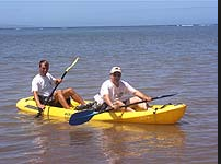 Kayak |
| Survey Equipment | Survey Info | Data Type(s) | Data Collected |
|---|---|---|---|
| GPS (wh) | --- | Navigation |
