Other ID: none
Status: Completed
Organization(s): USGS, Woods Hole Coastal and Marine Science Center
Funding Program(s):
Principal Investigator(s): Uri Ten Brink
Affiliate Investigator(s):
Information Specialist(s): Brian Andrews
Data Type(s): Sonar: Single Beam
Scientific Purpose/Goals: map shelf edge canyons
Vehicle(s):
Start Port/Location: Woods Hole
End Port/Location: Woods Hole
Start Date: 2012-06-29
End Date: 2012-07-03
Equipment Used: Echosounder
Information to be Derived: Bathymetric maps;
Summary of Activity and Data Gathered: Collected 418 sq km of multibeam bathymetry in Welker, Hydrographer, and Veatch Canyons on the NOAA Ship Nancy Foster using a Simrad EM1002.
Staff: Brian Andrews, Jerry Charles, Racheal Ferreira
Affiliate Staff:
Notes:
Project = NRC/Tsunami Landslide,
Location:
New Engalnd continental margin, United States, North America, North Atlantic
| Boundaries | |||
|---|---|---|---|
| North: 40.2648 | South: 39.9027 | West: -69.6016 | East: -68.29193 |
Platform(s):
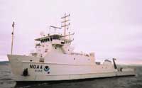 Nancy Foster |
Andrews, B.D., Chaytor, J.D., ten Brink, U.S., Brothers, D.S., Gardner, J.V., Lobecker, E.A., and Calder, B.R., 2013, Bathymetric terrain model of the Atlantic margin for marine geological investigations (ver. 2.0, May 2016): U.S. Geological Survey Open-File Report 2012–1266, 19 p., 1 pl., https://doi.org/10.3133/ofr20121266.
| Survey Equipment | Survey Info | Data Type(s) | Data Collected |
|---|---|---|---|
| Echosounder | --- | Single Beam | 2012-010-FA-BA-001 (518 kilometers of bathymetric data collected between July 1-3, 2013 on board the NOAA Ship Nancy Foster using their SIMRAD EM1002 (95 kHz). Woods Hole to Woods Hole) |
