Other ID: 12035
Status: Completed
Organization(s): USGS, Woods Hole Coastal and Marine Science Center
Funding Program(s):
Principal Investigator(s): Seth Ackerman
Affiliate Investigator(s): Dan Sampson, Massachusetts Coastal Zone Management
Information Specialist(s): Seth Ackerman
Data Type(s): Biological Field Study: Experiments (biological), Biological Field Study: Surveys (biological), Imagery: Photo, Imagery: Video, Sampling: Biology, Sampling: Geology, Visual Identification: Species ID, Location-Elevation: Navigation
Scientific Purpose/Goals: Sediment Grab Samples and Seafloor Photography/Video
Vehicle(s):
Start Port/Location: Boston
End Port/Location: Boston
Start Date: 2012-08-21
End Date: 2012-08-27
Equipment Used: Osprey camera system, Canon G12, Garmin GPS 76, SeaBOSS
Information to be Derived: Grain size analysis;Sea floor map;
Summary of Activity and Data Gathered: Sampling survey on the EPA's OSV Bold using the InterOcean-configuration SEABOSS. 350 sites were occupied to collect sediment samples, video and/or photos aboard the EPA OSV BOLD
Staff: Dann Blackwood, Marinna Martini
Affiliate Staff:
Katherine Yee (USGS)
Mike Bastoni (MassDOT)
Marcel Belaval (U.S. EPA)
Bob Boeri (MassCZM)
Marc Carullo (MassCZM)
Lisa Engler (Mass Bay Program)
Tay Evans (MassDMF)
Chris Garby (MassCZM)
Emily Huntley (MassCZM)
Julia Knisel (MassCZM)
Regina Lyons (U.S. EPA)
Stephen Perkins (U.S. EPA)
Jim Sprague (MassDEP)
Brendan Sprague (MassCZM intern)
Alex Strysky (MassDEP)
Steve Voss (MassDMF)
Notes:
Project = MCZM/B. Bay & Vineyard Sound,
Location:
Cape Cod Bay, Massachusetts, United States, North America, North Atlantic;,
| Boundaries | |||
|---|---|---|---|
| North: 42.69859 | South: 41.82864 | West: -70.9167 | East: -70.04883 |
Platform(s):
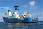 OSV Bold |
Huntley, E.C., Ackerman, S.D., Boeri, R.L., Callaghan, T.P., Sampson, D.W., and Blackwood, D.S., 2018, Sampling data collected in Ipswich Bay and Massachusetts Bay, Massachusetts, in 2012, U.S. Geological Survey Field Activity 2012-035-FA: U.S. Geological Survey data release, https://doi.org/10.5066/P924M8R1.
FAN 2012-035-FA has data viewable in the CMGP Video and Photograph Portal. View the data in this application here. See the instructions for working with this application.
| Title | Survey Equipment | Description |
|---|---|---|
| Cruise log | (document not focused on specific equipment) | Acquisition log maintained during field activity 2012-035-FA by the U.S. Geological Survey and Massachusetts Office of Coastal Zone Management in Ipswich Bay and Massachusetts Bay, Massachusetts, in August 2012 (Excel spreadsheet) |
| Survey Equipment | Survey Info | Data Type(s) | Data Collected |
|---|---|---|---|
| Osprey camera system | Kongsberg Simrad OE1365 video camera | Photo Video | 2012-035-FA_videos (Location of bottom video tracklines collected during field activity 2012-035-FA by the U.S. Geological Survey and Massachusetts Office of Coastal Zone Management in Ipswich Bay and Massachusetts Bay, Massachusetts, in August 2012) |
| Canon G12 | --- | Photo | 2012-035-FA_photos (Location of bottom still imagery along with images collected during field activity 2012-035-FA by the U.S. Geological Survey and Massachusetts Office of Coastal Zone Management in Ipswich Bay and Massachusetts Bay, Massachusetts, in August 2012. There are a few frame grab images from the video system.) |
| Garmin GPS 76 | Garmin GPSMAP 76CSx receiver | Navigation | 2012-035-FA_nav (Text files of the navigation logged during field activity 2012-035-FA by the U.S. Geological Survey and Massachusetts Office of Coastal Zone Management in Ipswich Bay and Massachusetts Bay, Massachusetts, in August 2012) |
| SeaBOSS | --- | Surveys (biological) Experiments (biological) Species ID Photo Video Geology Biology | 2012-035-FA_samples (Location and analysis of sediment samples collected during field activity 2012-035-FA by the U.S. Geological Survey and Massachusetts Office of Coastal Zone Management in Ipswich Bay and Massachusetts Bay, Massachusetts, in August 2012) |
