Other ID: none
Status: Completed
Organization(s): USGS, Woods Hole Coastal and Marine Science Center
Funding Program(s):
Principal Investigator(s): Neil Kamal Ganju
Affiliate Investigator(s):
Information Specialist(s): Patrick Dickhudt
Data Type(s): Imagery: Photo, Time Series: Mooring (physical oceanography)
Scientific Purpose/Goals: Deploy water quality sensors and Aquadopp HR in Pt. Mugu marsh.
Vehicle(s):
Start Port/Location: Oxnard, CA
End Port/Location: Oxnard, CA
Start Date: 2013-04-08
End Date: 2013-04-13
Equipment Used: Digital camera, Current
Information to be Derived: Time series data;
Summary of Activity and Data Gathered: Sensors deployed. Data will be acquired upon recovery.
Staff: Patrick Dickhudt
Affiliate Staff:
Notes: Project = Estuarine Modeling & Observation,
Location:
Point Mugu, Oxnard, California, United States, North America
| Boundaries | |||
|---|---|---|---|
| North: 34.11378 | South: 34.09091 | West: -119.1 | East: -119.07394 |
Platform(s):
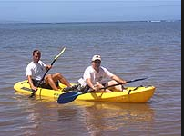 Kayak |
Ganju, N.K., Dickhudt, P.J., Montgomery, E.T., and Brosnahan, S.M., 2016, Oceanographic and water quality measurements in two Southern California Coastal Wetlands, 2013-2014: U.S. Geological Survey data release, https://doi.org/10.5066/F78050PZ.
| Survey Equipment | Survey Info | Data Type(s) | Data Collected |
|---|---|---|---|
| Digital camera | --- | Photo | |
| Current | --- | Mooring (physical oceanography) |
