Other ID: none
Status: Completed
Organization(s): USGS, Woods Hole Coastal and Marine Science Center
Funding Program(s): Other (Other)
Principal Investigator(s): Carolyn Ruppel
Affiliate Investigator(s):
Information Specialist(s): Carolyn Ruppel
Data Type(s): Location-Elevation: Navigation
Scientific Purpose/Goals: Image methane plumes offshore Nantucket in support of collaborative water column sampling activity
Vehicle(s):
Start Port/Location: URI
End Port/Location: URI
Start Date: 2014-07-02
End Date: 2014-07-09
Equipment Used: HYPACK
Information to be Derived: water column imagery, geochemical samples
Summary of Activity and Data Gathered: Samples and data collected in collaboration with URI
Staff: Carolyn Ruppel
Affiliate Staff:
Notes: No operations personnel, only Ruppel;
Location:
Nantucket margin, shelf break to continental slope, Massachusetts
| Boundaries | |||
|---|---|---|---|
| North: 41.70573 | South: 40.44695 | West: -71.6309 | East: -69.43359 |
Platform(s):
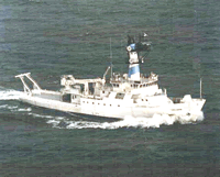 Endeavor |
| Survey Equipment | Survey Info | Data Type(s) | Data Collected |
|---|---|---|---|
| HYPACK | --- | Navigation |
