Other ID: MGL1407
Status: Completed
Organization(s): USGS, Woods Hole Coastal and Marine Science Center
Funding Program(s): Law of the Sea - Outer Limits of the US Continental Margins (LQ000FQ)
Principal Investigator(s): Deborah Hutchinson, Nathaniel Miller
Affiliate Investigator(s):
Information Specialist(s): Matthew Arsenault
Data Type(s): Electro-Magnetic: Gravity, Electro-Magnetic: Magnetics, Location-Elevation: Navigation, Seismics: Air Gun / Water Gun, Seismics: Multichannel, Seismics: Sub Bottom Profiler, Sonar: Multibeam
Scientific Purpose/Goals: To map sediment thickness in order to define the outer limits of the U.S. Extended Continental Shelf beyond 200 nautical miles; and to better understand landslide processes on the Atlantic margin.
Vehicle(s):
Start Port/Location: Newark, NJ
End Port/Location: Norfolk, VA
Start Date: 2014-08-13
End Date: 2014-09-05
Equipment Used: Multichannel seismics, Air gun, Knudsen echo sounder 320B/R, Geometrics G-856 magnetometer, Bell Aerospace BGM-3 gravimeter, DGPS, Other, EM122 12 kHz multibeam
Information to be Derived: Sediment thickness, location of fracture zones
Summary of Activity and Data Gathered: Magnetics and gravity data, seismics and sonar.
Staff: Matthew Arsenault, Wayne Baldwin, David Foster, Deborah Hutchinson, Eric Moore, Thomas O'Brien
Affiliate Staff:
Notes: Draft environmental compliance documents and permits were completed in April. USGS EA for 2014-011-FA is posted at:
https://woodshole.er.usgs.gov/project-pages/environmental_compliance/index.html
Location:
Atlantic Continental Margin, (NC to Maine), United States, North America, North Atlantic
| Boundaries | |||
|---|---|---|---|
| North: 43.16512263 | South: 32.61671135 | West: -78.3984 | East: -67.421877 |
Platform(s):
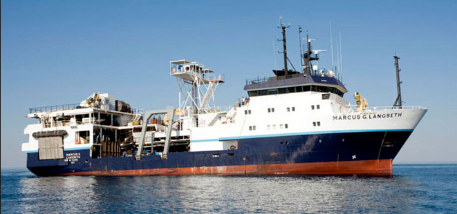 Marcus G. Langseth |
Arsenault, M.A., Miller, N.C., Hutchinson, D.R., Baldwin, W.E., Moore, E.M., Foster, D.S., O'Brien, T.F., and Fortin, W.F., 2017, Geophysical data collected along the Atlantic continental slope and rise 2014, U.S. Geological Survey Field Activity 2014-011-FA, cruise MGL1407: U.S. Geological Survey data release, https://doi.org/10.5066/F7V69HHS.
| Survey Equipment | Survey Info | Data Type(s) | Data Collected |
|---|---|---|---|
| Multichannel seismics | 8-km-long solid state digital hydrophone streamer - Sentry Solid Streamer Sercel hydrophone cable consists of 12 hydrophones, which are summed in analog, and the spacing between the center of these groups is 12.5 m. Streamer depth was set to 9 m for all lines | Multichannel | 2014-011-FA_mcscmp (Unique common mid-point (cmp) navigation for multi-channel seismic data collected by the U.S. Geological Survey on U.S. Atlantic Seaboard in 2014) 2014-011-FA_poststmsegy (Post-stack migrated SEG-Y multi-channel seismic data collected by the U.S. Geological Survey in U.S. Atlantic Seaboard in 2014) 2014-011-FA_seistrk (Trackline navigation for multi-channel seismic data collected by the U.S. Geological Survey on U.S. Atlantic Seaboard in 2014) |
| Air gun | 36-element, 6600 cubic inch airgun source array configured in four parallel, 9-gun strings | Air Gun / Water Gun | |
| Knudsen echo sounder 320B/R | --- | Sub Bottom Profiler | |
| Geometrics G-856 magnetometer | --- | Magnetics | 2014-011-FA_mag (Marine magnetics data collected by the U.S. Geological Survey in U.S. Atlantic Seaboard in 2014) |
| Bell Aerospace BGM-3 gravimeter | --- | Gravity | |
| DGPS | --- | Navigation | |
| Other | --- | --- | --- |
| EM122 12 kHz multibeam | --- | Multibeam |
