Other ID: none
Status: Completed
Organization(s): USGS, Woods Hole Coastal and Marine Science Center
Funding Program(s): Other (Other)
Principal Investigator(s): Daniel Brothers
Affiliate Investigator(s):
Information Specialist(s): Daniel Brothers
Data Type(s): Seismics: Multichannel
Scientific Purpose/Goals: Seismic mapping in Catalina Basin, Santa Monica Basin
Vehicle(s):
Start Port/Location: San Diego, CA
End Port/Location: San Diego, CA
Start Date: 2014-11-12
End Date: 2014-11-25
Equipment Used:
Information to be Derived: no data
Summary of Activity and Data Gathered:
Staff:
Affiliate Staff:
Notes: OT = 44
Woods Hole will provide equipment and personnel (1 person) for a PCMSC research program. Woods Hole will provide: 48-channel MCS streamer, 4 birds, peripherals, SIG mini-sparker w/power supply.
Updated information based on email from Danny Brothers - and indicating the related activity is 2014-065-FA
Location:
Los Angeles, California, United States, North America, North Pacific
| Boundaries | |||
|---|---|---|---|
| North: 33.90576 | South: 32.73388 | West: -119.8981 | East: -117.19542 |
Platform(s):
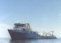 Robert Gordon Sproul |
