Equipment

DATA ACQUISITION EQUIPMENT

U.S. GEOLOGICAL SURVEY
WOODS HOLE FIELD CENTER (WHFC)

Sidescan-Sonar Towfish:


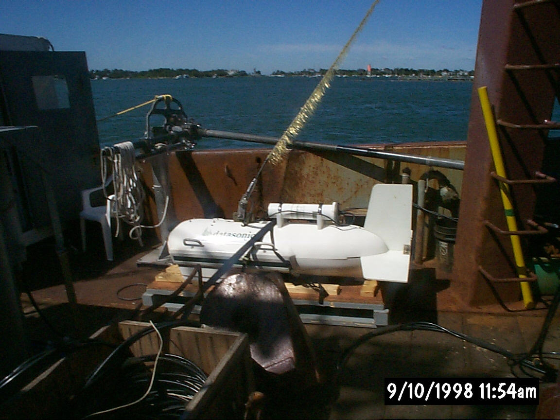
Datasonics model SIS-1000 (100 kHz).
Data Collection Platform:


Triton Elics International ISIS®

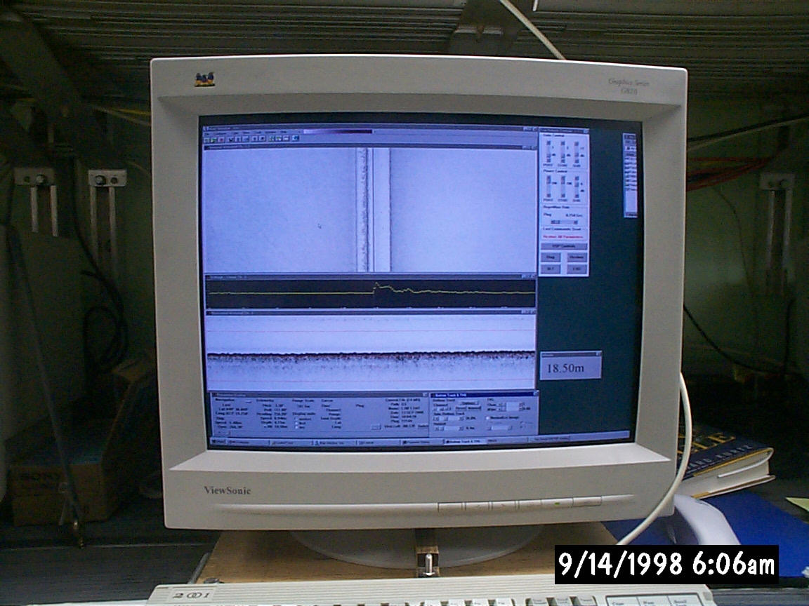
Specifications for the Sidescan-Sonar portion of the SIS-1000:
(for more information, see Benthos, Inc.)

Sidescan Transducers: Multi-element array; single array transmit, dual array receivers -- 0.5-degree horizontal beam; 60-degree vertical beam

Frequency: 100 kHz band swept FM, port and starboard channels sweeping in opposite directions; 7.5 cm resolution

Processing:
Calibrated transmit waveform stored in ROM; match filter FFT digital signal processing

Swath (range) Selection:
+/- 50 meters to +/- 70 meters
Tow Vehicle Specifications:

Depth rating: 1000 meters
Vehicle dimensions: 18 inches OD x 64 inches long
Weight: in air: 300lbs; in water: 170 lbs
--Windows 95 based Pentium machine
--Saves sidescan-sonar data via network interface or on an Exabyte 8200 tape subsystem
--Will accept up to 5 channels of data
--Serial I/O ports (i.e., for navigation)
--Parallel (Centronics) ports for printing the sidescan-sonar data
--Array processor handling the digitized sidescan-sonar signal
--12-bit analog to digital converter OR: DSP card for digital signals


The topside data acquisition computer the USGS uses to collect and store the digital signal is the ISIS(TM) system, which runs under the Windows 95 operating system and is built by Triton Elics International, Inc., Watsonville, CA using a 12-bit (72 db effective dynamic range) A/D converter in conjunction with an array processor. ISIS(TM) is capable of digitizing up to four channels of information at aggregate rates of up to 750 kHz, thus preserving the content and the dynamic range of the sidescan-sonar signal. An installed Digital Signal Processing (DSP) board is an alternative to handling signals digitized at the towfish (SIS-1000). Port and starboard sidescan-sonar data are displayed in real-time on a high-resolution color display (1280 x 1024 pixels). Telemetry from navigation systems and the towfish, including full towfish attitude information, is displayed in separate windows. The backup data storage media used is 8 mm Exabyte tape.  The USGS WHFC records directly to disc on separate computer systems using the Network File System (NFS) protocol and archives the data to DVD-ROM.


Sidescan-Sonar files collected using the ISIS(TM) system have the following format (Q-MIPS):
     1st rec   ----    ----    ---- *** Data is stored in 
        |      ----    ----    ---- *** 1024 byte records for
        |        .                            each channel
        |        .                      (*** 256 byte trailer.)
        |        .
        |        .
        V        .
      End rec  ----    ----    ---- ***
               Chan    Chan2   ChanX  (*** = 256 byte trailer.)

Each data file contains a 2048 byte file header followed by the sidescan-sonar data stream which consists of at least two channels of sidescan-sonar information and a 256 byte trailer. The trailer contains parameters relevant to the collected sidescan-sonar, such as altitude, file name, pitch, roll, date of collection, time of day, etc. The isis header and Isis sonar formats for the ISIS are described on the Q-MIPS page.


Browse the Q-MIPS file format...

Return to the data page

Return to USGS Cruise SEAX 96004 home page