USGS - science for a changing world

USGS Coastal and Marine Geology Program

GIS of Selected Geophysical and Core Data in the Northern Gulf of Mexico Continental Slope Collected by the U.S. Geological Survey

OF 2005-1071 Home

Overview

Geologic Findings

GIS Data Catalog

References Cited

Acknowledgements

Contacts

Disclaimer

A figure showing shaded-relief bathymetry with pronounced minibasins.

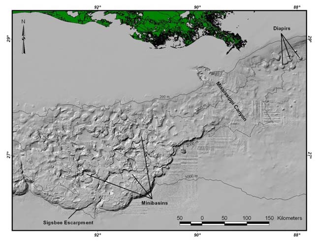
Figure 3. Shaded-relief image of the bathymetry of part of the continental slope and rise in the northern Gulf of Mexico. This section of the continental slope is underlain by salt, and the complex morphology of the seafloor, which includes subcircular basins (minibasins) and circular mounds (diapirs), is due to deformation of the underlying salt.

Skip Navigation

Accessibility FOIA Privacy Policies and Notices

U.S. Department of the Interior | U.S. Geological Survey | Coastal and Marine Geology

URL: cmgds.marine.usgs.gov/publications/of2005-1071/htmldocs/figure3.htm
Page Contact Information: CMGDS Team
Page Last Modified: Wednesday, 06-Dec-2017 12:38:19 EST