Skip USGS links group
USGS - science for a changing world

Woods Hole Science Center

End of USGS links group
GIS of Selected Geophysical and Core Data in the Northern Gulf of Mexico Continental Slope Collected by the U.S. Geological Survey

OF 2005-1071 Home

Overview

Geologic Findings

GIS Data Catalog

References Cited

Acknowledgements

Contacts

Disclaimer

An image showing tracklines where seismic-reflection profiles were collected.

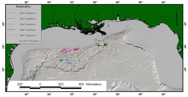
Figure 8. Distribution of seismic-reflection profiles collected by the USGS in the deep-water part of the Gulf of Mexico since 1982. The "Seismic" directory of the GIS contains shapefiles for these datasets as well as images of all the seismic profiles exclusive of the GLORIA survey.

Skip USGS links group

Accessibility FOIA Privacy Policies and Notices

Take Pride in America logo USAGov logo U.S. Department of the Interior | U.S. Geological Survey
End of USGS links group
URL: woodshole.er.usgs.gov/pubs/of2005-1071/htmldocs/figure8.htm
Page Contact Information: WHSC Webmaster
Page Last Modified: Friday, 25-May-2007 08:32:56 EDT