USGS - science for a changing world

USGS Coastal and Marine Geology Program

U.S. Geological Survey Open-File Report 2005-1429

South Carolina Coastal Erosion Study
Data Report for Observations
October 2003 - April 2004

Published 2006

Figure 1. Location map for Long Bay, South Carolina. Location map for Long Bay, South Carolina.
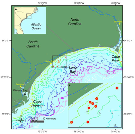
Figure 1. Location map for Long Bay, South Carolina. Click on figure for larger image (PDF format).

By Charlene M. Sullivan, John C. Warner, Marinna A. Martini, George Voulgaris, Paul A. Work, Kevin A. Haas, and Daniel Hanes

Link to enter the data report
Click arrow to enter publication


adobe reader To view files in PDF format, download free copy of Adobe Reader.


Any use of trade names is for descriptive purposes only and does not imply endorsement by the U.S. Government.


Skip Navigation

Accessibility FOIA Privacy Policies and Notices

U.S. Department of the Interior | U.S. Geological Survey | Coastal and Marine Geology

URL: cmgds.marine.usgs.gov/publications/of2005-1429/start.html
Page Contact Information: CMGDS Team
Page Last Modified: Wednesday, 06-Dec-2017 12:51:27 EST