Data format: Raster Dataset - TIFF
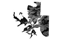
File or table name: bh_1mBS.tif
Coordinate system: Universal Transverse Mercator
Theme keywords: U.S. Geological Survey, USGS, Coastal and Marine Geology Program, CMGP, Woods Hole Science Center, WHSC, Massachusetts Office of Coastal Zone Management, CZM, Seafloor, Marine Geology, Sidescan, Sidescan Sonar, Edgetech, 272-T, Klein, 5500, National Oceanic and Atmospheric Administration, NOAA, National Ocean Service, NOS, NOAA Ship Whiting, Hydrographic Survey, GeoTIFF image, greyscale image, oceans and estuaries, imageryBaseMapsEarthCover, geoscientificinformation