USGS - science for a changing world

USGS Coastal and Marine Geology Program

High-Resolution Geologic Mapping of the Inner Continental Shelf: Boston Harbor and Approaches, Massachusetts

Title Page / Table of Contents / List of Figures / Introduction / Maps / Data Collection/Processing / Interpretation / Acknowledgments / Appendix 1 / Appendix 2 / Appendix 3 /


Figure 1.2. Map showing the location of the four NOAA hydrographic surveys, conducted in 2000 and 2001, that were used for this project.

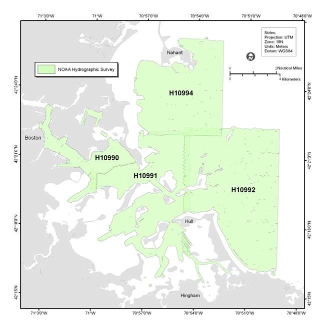
Figure 1.2. Map showing the location of the NOAA hydrographic surveys H10990, H10991, H10992, and H0994 that collected the bathymetry and sidescan-sonar data used to map the sea floor of Boston Harbor and Approaches.

Click here for a larger JPG image

Skip Navigation

Accessibility FOIA Privacy Policies and Notices

U.S. Department of the Interior | U.S. Geological Survey | Coastal and Marine Geology

URL: cmgds.marine.usgs.gov/publications/of2006-1008/html/imagepages/f1_2.html
Page Contact Information: CMGDS Team
Page Last Modified: Wednesday, 06-Dec-2017 12:55:27 EST