USGS - science for a changing world

USGS Coastal and Marine Geology Program

High-Resolution Geologic Mapping of the Inner Continental Shelf: Boston Harbor and Approaches, Massachusetts

Title Page / Table of Contents / List of Figures / Introduction / Maps / Data Collection/Processing / Interpretation / Acknowledgments / Appendix 1 / Appendix 2 / Appendix 3 /


Figure 3.2. Photograph of the USGS research vessel Rafael

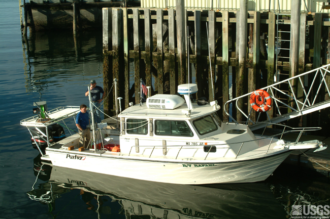
Figure 3.2. Photograph of the USGS research vessel Rafael.  The Rafael is 25’ long and used by USGS to conduct geophysical surveys in coastal areas.

Click here for a larger JPG Image

Skip Navigation

Accessibility FOIA Privacy Policies and Notices

U.S. Department of the Interior | U.S. Geological Survey | Coastal and Marine Geology

URL: cmgds.marine.usgs.gov/publications/of2006-1008/html/imagepages/f3_2.html
Page Contact Information: CMGDS Team
Page Last Modified: Wednesday, 06-Dec-2017 12:55:27 EST