USGS - science for a changing world

USGS Coastal and Marine Geology Program

High-Resolution Geologic Mapping of the Inner Continental Shelf: Boston Harbor and Approaches, Massachusetts

Title Page / Table of Contents / List of Figures / Introduction / Maps / Data Collection/Processing / Interpretation / Acknowledgments / Appendix 1 / Appendix 2 / Appendix 3 /


Figure 3.3. TOP: Photograph of Mini SEABOSS and winch on the deck of the RV Rafael. BOTTOM: Components of Mini SEABOSS viewed from belowFigure 3.3. TOP: Photograph of Mini SEABOSS and winch on the deck of the RV Rafael. BOTTOM: Components of Mini SEABOSS viewed from belowFigure 3.3. TOP: Photograph of Mini SEABOSS and winch on the deck of the RV Rafael. BOTTOM: Components of Mini SEABOSS viewed from below

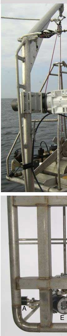
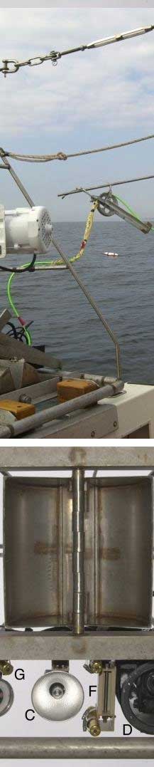
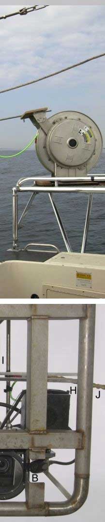
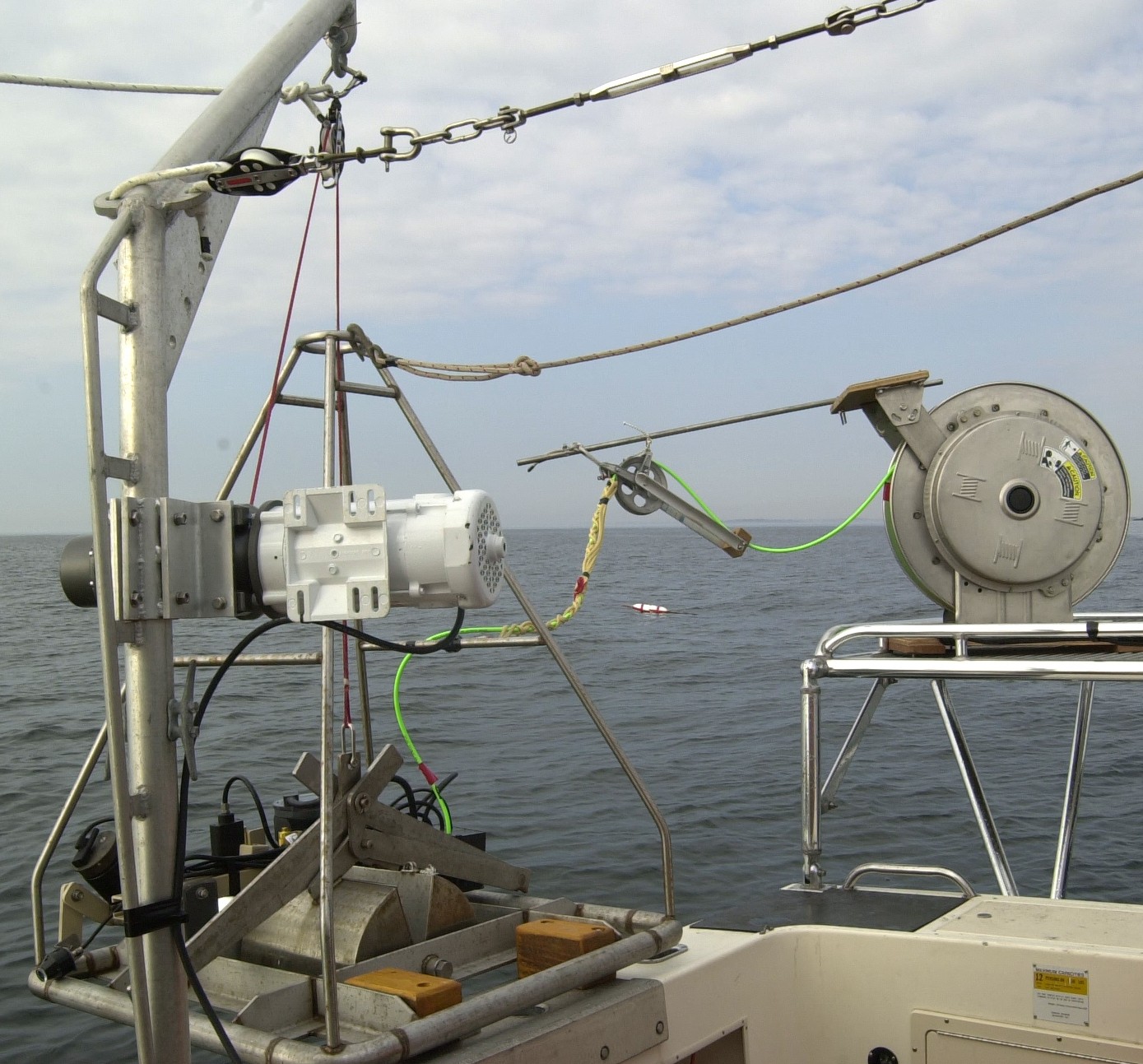
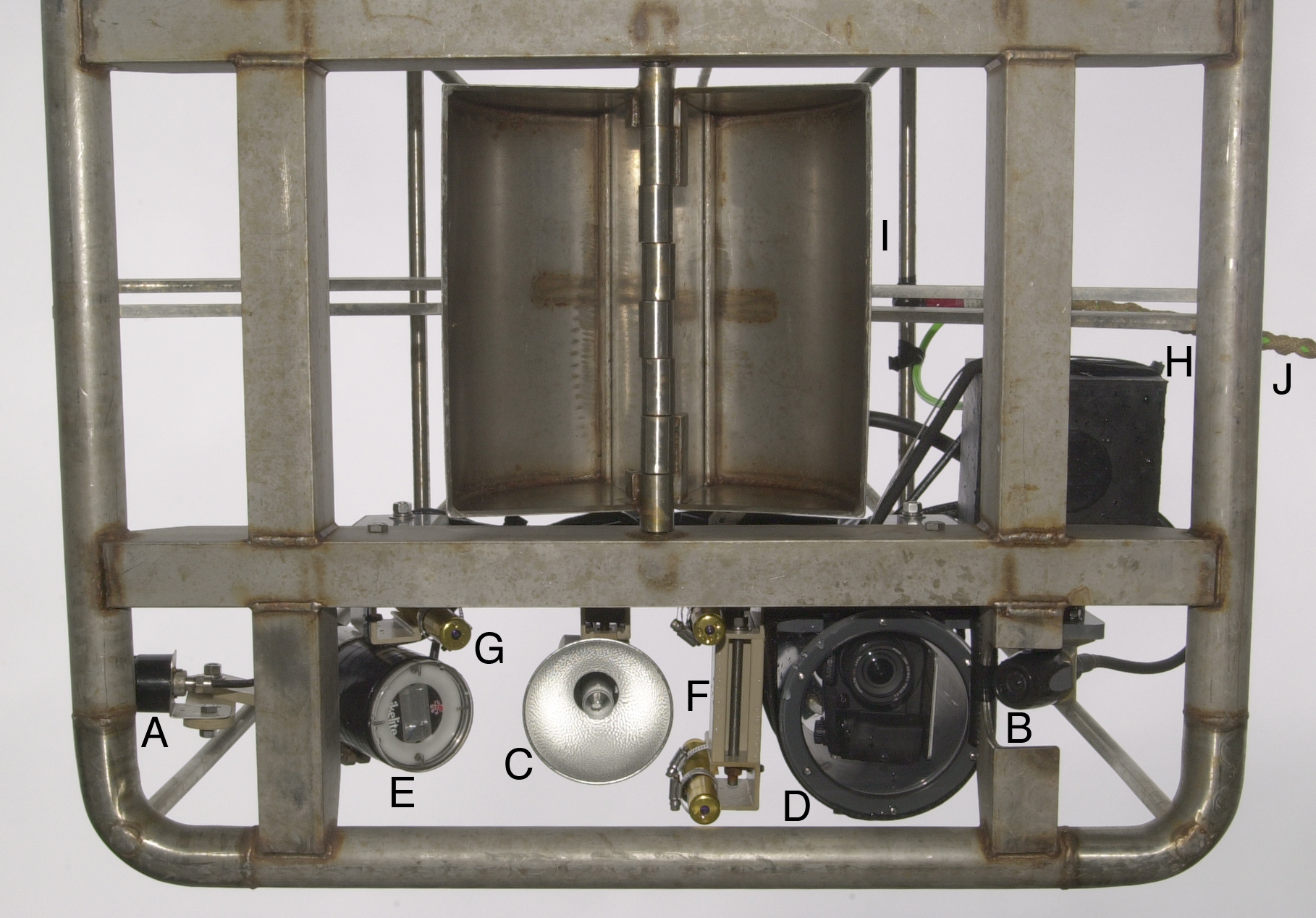
Figure 3.3. TOP: Photograph of Mini SEABOSS and winch on the deck of the RV Rafael.  On the Rafael, the SEABOSS sits on a frame mounted outboard of the vessel.  The conducting cable that carries power and the video signal is stored on the cable spool.  BOTTOM: Components of Mini SEABOSS viewed from below: A) forward video camera; B) downward video camera; C) video light; D) digital still camera and housing; E) strobe light; F) parallel laser for scale; G, laser for ranging; H) junction block; I) van Veen grab sampler; and J) multi-conducting cable.

Click here for a larger JPG image - SEABOSS top image

Click here for a larger JPG image - SEABOSS bottom image

Skip Navigation

Accessibility FOIA Privacy Policies and Notices

U.S. Department of the Interior | U.S. Geological Survey | Coastal and Marine Geology

URL: cmgds.marine.usgs.gov/publications/of2006-1008/html/imagepages/f3_3.html
Page Contact Information: CMGDS Team
Page Last Modified: Wednesday, 06-Dec-2017 12:55:27 EST