USGS Coastal and Marine Geology Program
Title Page /
Table of Contents /
List of Figures /
Introduction /
Maps / Data Collection/Processing / Interpretation / Acknowledgments / Appendix 1 / Appendix 2 /
Appendix 3 /
 |
||
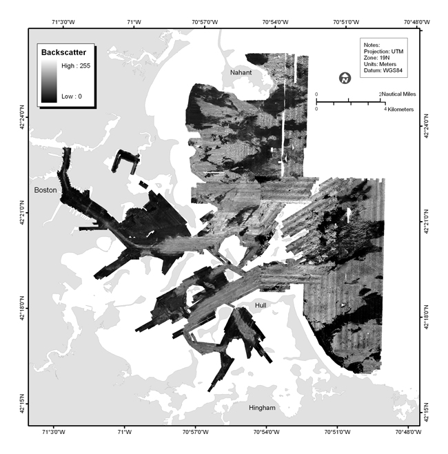
Figure 3.4. Map showing mosaic of sidescan-sonar data of the survey area Boston Harbor and Approaches, Massachusetts. Backscatter intensity, as recorded with sidescan-sonar, is an acoustic measure of the hardness and roughness of the seafloor. In general, higher values (light tones) represent rock, gravel and coarse sand. Lower values (dark tones) generally represent fine sand and muddy sediment. See map sheet 3 for data at a scale of 1:25,000. |
