USGS Coastal and Marine Geology Program
Title Page /
Table of Contents /
List of Figures /
Introduction /
Maps / Data Collection/Processing / Interpretation / Acknowledgments / Appendix 1 / Appendix 2 /
Appendix 3 /
 |
||
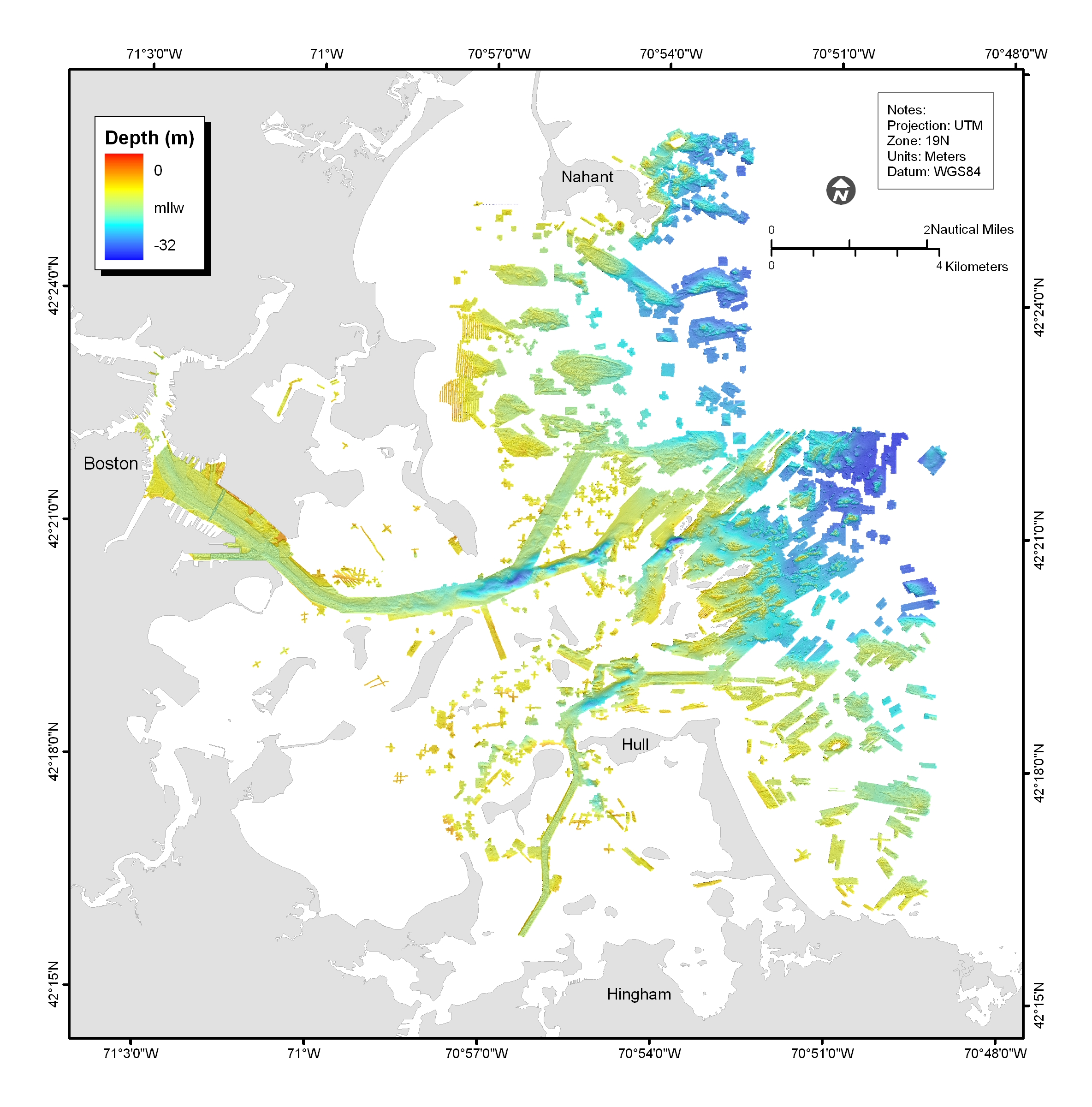
Figure 3.5. Shaded-relief bathymetric map, colored by water depth, of Boston Harbor and Approaches, Massachusetts based on the multibeam sonar data (gridded at 2 m). See map sheet 2 for date at a scale of 1:25,000. |
