USGS Coastal and Marine Geology Program
Title Page /
Table of Contents /
List of Figures /
Introduction /
Maps / Data Collection/Processing / Interpretation / Acknowledgments / Appendix 1 / Appendix 2 /
Appendix 3 /
 |
||
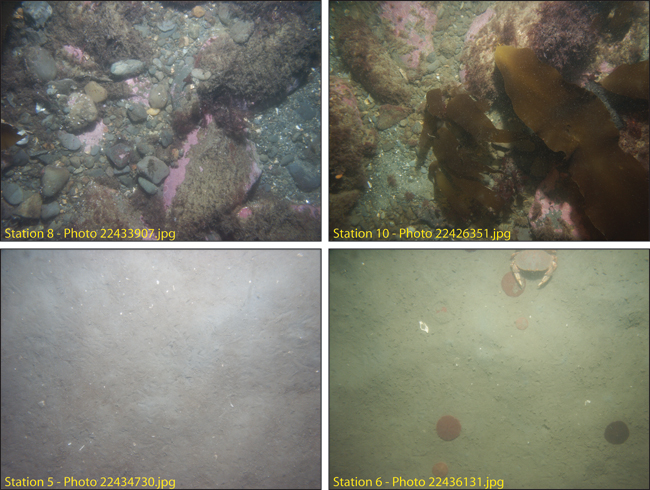
Figure 4.18. Photographs of the sea floor in areas of elevated topography, rough sea floor, and high backscatter intensity (stations 8 and 10, 11.0 and 11.5 m water depth respectively) east of Nantasket. The pink on the boulders is calcareous algae. The sea floor between these features is sand (stations 5, 6, 13.4 and 16.0 m water depth respectively). See Figure 4.17b for station locations. See Appendix 3 for additional photographs at these stations. The field of view of each image is approximately 50 cm wide. | ||
