USGS Coastal and Marine Geology Program
Title Page /
Table of Contents /
List of Figures /
Introduction /
Maps / Data Collection/Processing / Interpretation / Acknowledgments / Appendix 1 / Appendix 2 /
Appendix 3 /
 |
||
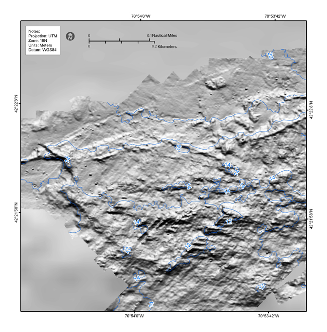
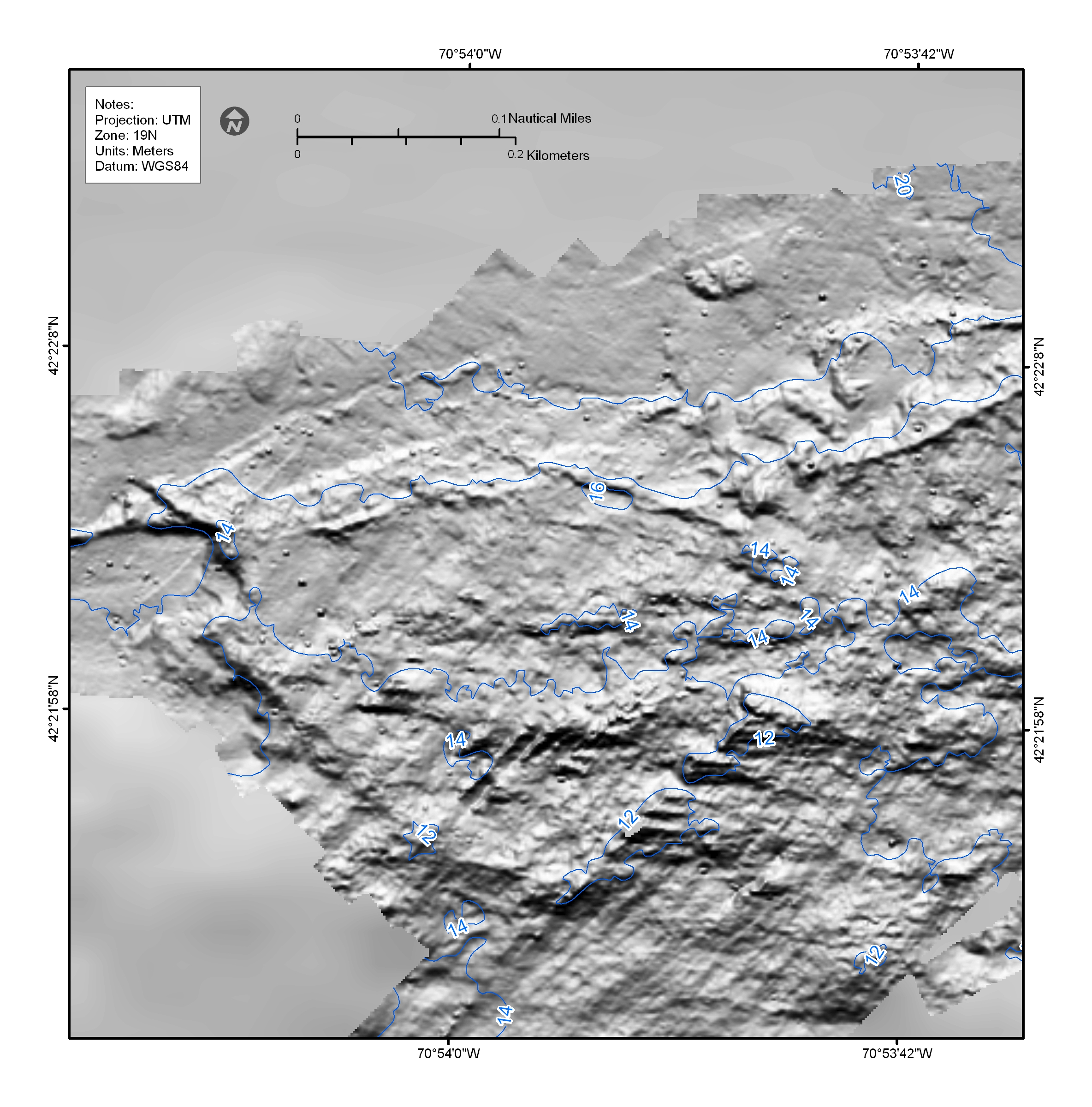
Figure 4.19. Shaded-relief bathymetric map showing numerous individual targets 4-6 m on a side and less than a meter high that are interpreted to be individual boulders. Similar targets are observed in the 2-m multibeam bathymetry in nearly all of the areas with a rough sea floor. See Figure 4.2 for map location. | ||
