USGS Coastal and Marine Geology Program
Title Page /
Table of Contents /
List of Figures /
Introduction /
Maps / Data Collection/Processing / Interpretation / Acknowledgments / Appendix 1 / Appendix 2 /
Appendix 3 /
 |
||
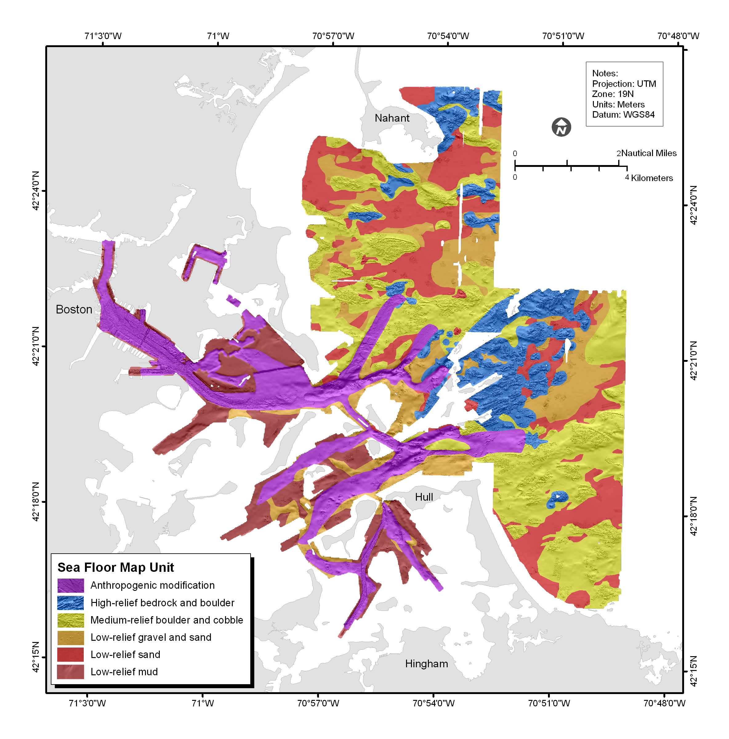
Figure 4.21. Physiographic units of the sea floor of Boston Harbor and Approaches, based on bottom roughness, backscatter intensity, and sediment texture. | ||
