USGS - science for a changing world

USGS Coastal and Marine Geology Program

High-Resolution Geologic Mapping of the Inner Continental Shelf: Boston Harbor and Approaches, Massachusetts

Title Page / Table of Contents / List of Figures / Introduction / Maps / Data Collection/Processing / Interpretation / Acknowledgments / Appendix 1 / Appendix 2 / Appendix 3 /


Figure A3.1. Map showing station locations of bottom photographs obtained in the Boston Harbor and Approaches region.

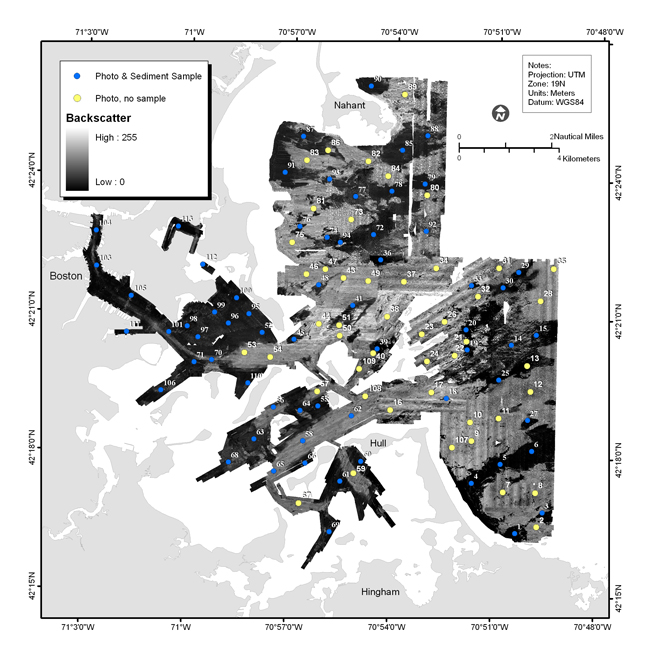
Figure A3.1. Map showing bottom sample locations and bottom photo locations overlain on the sidescan-sonar imagery. Photographs and video were obtained at all sites. Samples could not be collected at sites where the bottom was cobble or rocky (yellow dots). See Appendix 3 for a photo gallery of the images from the ground-truth survey.

Skip Navigation

Accessibility FOIA Privacy Policies and Notices

U.S. Department of the Interior | U.S. Geological Survey | Coastal and Marine Geology

URL: cmgds.marine.usgs.gov/publications/of2006-1008/html/imagepages/fa3_1.html
Page Contact Information: CMGDS Team
Page Last Modified: Wednesday, 06-Dec-2017 12:55:27 EST