USGS Coastal and Marine Geology Program
![]() Title | Geologic Setting | Introduction
| Methods | Bathymetric Overview |
Interpretation | Data Catalog
| Acknowledgments | References
| Figures
| Contacts
Title | Geologic Setting | Introduction
| Methods | Bathymetric Overview |
Interpretation | Data Catalog
| Acknowledgments | References
| Figures
| Contacts
 |
||
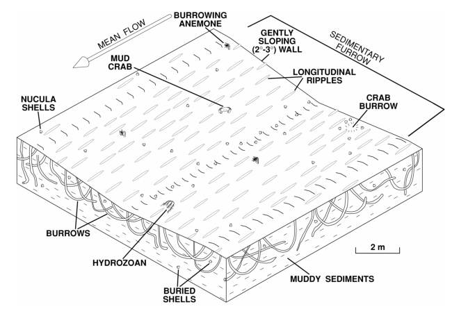
Figure 10. Image shows a perspective view of an idealized sedimentary furrow in the muddy cohesive sediments of Long Island Sound. Figure shows the linear depression with gently sloping walls, longitudinal ripples, bioturbation, and nucula shells. | ||
