USGS Coastal and Marine Geology Program
![]() Title | Geologic Setting | Introduction
| Methods | Bathymetric Overview |
Interpretation | Data Catalog
| Acknowledgments | References
| Figures
| Contacts
Title | Geologic Setting | Introduction
| Methods | Bathymetric Overview |
Interpretation | Data Catalog
| Acknowledgments | References
| Figures
| Contacts
 |
||
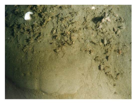
Figure 15. Bottom photograph showing an example of a sedimentary environment characterized by sorting or reworking. Note the sandy muddy sediment and scattered shell debris. Bottom photo is from Niantic Bay in Long Island Sound (Poppe and others, 2000b). | ||
