USGS Coastal and Marine Geology Program
![]() Title | Geologic Setting | Introduction
| Methods | Bathymetric Overview |
Interpretation | Data Catalog
| Acknowledgments | References
| Figures
| Contacts
Title | Geologic Setting | Introduction
| Methods | Bathymetric Overview |
Interpretation | Data Catalog
| Acknowledgments | References
| Figures
| Contacts
 |
||
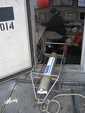
Figure 3. CTD (conductivity-temperature-depth) profiler shown on the deck of the NOAA ship Thomas Jefferson. Data derived from frequent deployments of this device were used to correct for variations in sound velocity throughout the water column. | ||
