USGS Coastal and Marine Geology Program
![]() Title | Geologic Setting | Introduction
| Methods | Bathymetric Overview |
Interpretation | Catalog
| Acknowledgments | References
| Figures
| Contacts
Title | Geologic Setting | Introduction
| Methods | Bathymetric Overview |
Interpretation | Catalog
| Acknowledgments | References
| Figures
| Contacts
 |
||
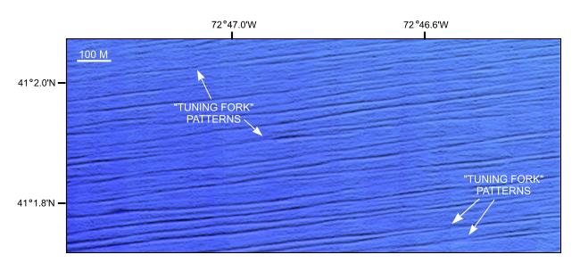
Figure 9. Detailed view of sedimentary furrows from the southwestern corner of NOAA survey H11255. "Tuning fork" joining pattern exhibited by some of the furrows typically open to the east (right) suggesting net westward transport. Location of this view and distribution of sedimentary furrows are shown in Figure 5. | ||
