Submarine Hydrogeological Data from Cape Cod National Seashore
by
VeeAnn A. Cross1, John F. Bratton1, John Crusius1,
John A. Colman2, and Timothy D. McCobb2
1 U.S. Geological Survey, 384 Woods Hole Road, Woods Hole, MA 02543-1598
2 U.S. Geological Survey, 10 Bearfoot Road, Northborough, MA 01532
Published 2008
Abstract
In order to test hypotheses about ground water flow under and into estuaries
and the Atlantic Ocean, geophysical surveys, geophysical probing, submarine
ground-water sampling, and sediment coring were conducted by U.S. Geological
Survey (USGS) scientists at Cape Cod National Seashore (CCNS) in Massachusetts
from 2004 through 2006. This USGS Open-File Report presents the data collected
as a result of these field efforts.
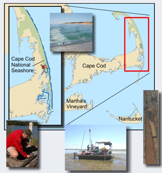 The locations on Cape Cod, Massachusetts where samples were taken.
Disclaimer
Any use of trade, product, or firm names is for descriptive purposes only and does not imply endorsement by the U.S. Government.
|
