Woods Hole Science Center
Surficial Geology in Central Narragansett Bay, Rhode Island: Interpretations of Sidescan Sonar and Multibeam Bathymetry
|
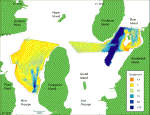
Two deep channels are conspicuous in the study areas' bathymetry (fig. 3). The smaller of these, located to the west of Conanicut Island, trends northward and is about 25-m deep. The channel in the eastern part of the study area, located between Prudence Island and Dyer Island, is oriented north-northeast and exceeds 30 m in depth. This trough coincides with part of a submerged valley, running about 30 km from the Providence River to Rhode Island Sound (McMaster, 1960). West Passage in Narragansett Bay does not have a continuous, deep channel like that in East Passage; instead it has short isolated troughs. Aside from the troughs, the study areas' bathymetry is generally flat or gently sloping, especially to the northeast and northwest of Conanicut Island; however, there are several small (about 15 m deep), irregular depressions to the east of Dyer Island and near the western coast of Narragansett Bay. The bathymetry of central Narragansett Bay shows signs of scour around rocks and bridge pilings, indicating prevailing current directions. Erosional pathways seen in the sidescan sonar imagery also suggest local current directions. The assortment of flow directions implied by scour marks and pathways reflects the variability of current influences in the study area. An exposed rock near the pier on Prudence Island shows signs of scour to its southwest, suggesting nearshore currents flow to the northeast in that area (fig. 4). The bathymetry shows scouring on the northern side of the Jamestown Bridge pilings and rocks in the trough to the northeast of the bridge, signifying prevailing southward bottom currents in this area of West Passage. Pathways in West Passage indicate the local bottom currents flow to the southeast, in down-slope direction. Several rocks to the north of Dyer Island show scour to their northeast; however, this is also the down-slope direction and scour may be due more to gravity than current flow. Other large rocks and shipwrecks in the study area show no dominant direction of scour, a likely result of variable current directions. |
Click on figures for larger images.
|